Waterway information

Kind:
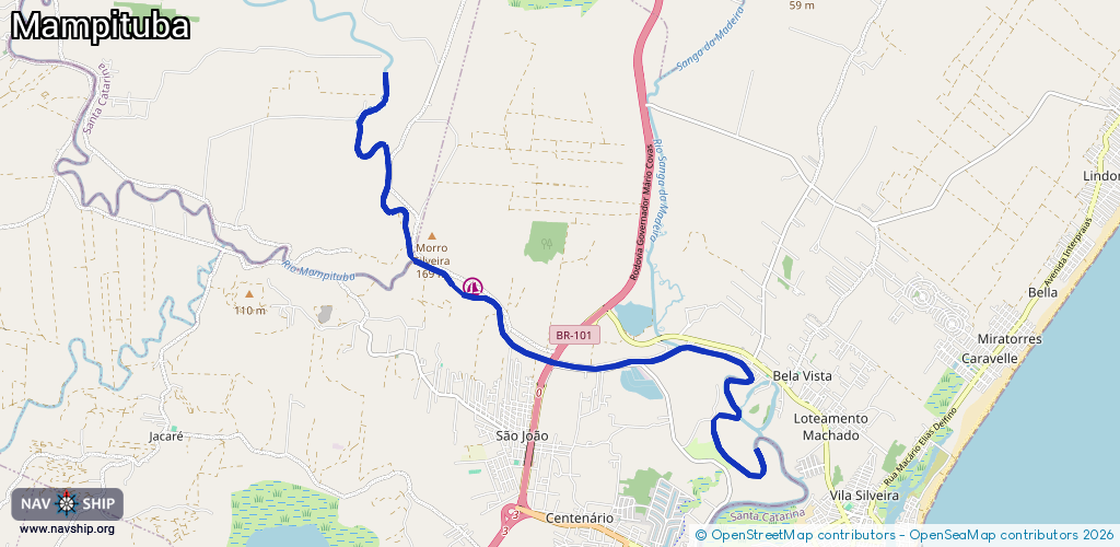
Inland
Driving areas:
🌊 Atlantic Ocean🇧🇷 Brazil
Length:
13.2 km¹
¹River kilometers or bank length recorded in NavShip, including river arms and harbor entrances.
Availability:
Completely recorded
Recent Update: 08.05.2025²
² This date indicates when an adjustment last took place in the course of the body of water
Recorded:
Locks: 0
Harbours / marinas: 1
Bridges: 0
Berths: 0
Slipways: 0
Fuelstations: 0
Route:
Please wait, loading route graphic...
Request waterway overview map with symbol legend here (Link).
Information about data associated with this body of water (1 available):
Data by OpenSeaMap (c) OSM contributors, www.openseamap.org
| # | Kind | Coordinates | Name | Information |
|---|---|---|---|---|
| 1 | Marina | -29.28925,-49.78243 | 2025-04-28T17:09:19Z | Marina Damasceno Marina com apartamentos para locação. 20 mil m² de área de lazer, lago privativo, quadras de esportes e barco de passeio [email protected] 51985288888 |