Waterway information

Kind:
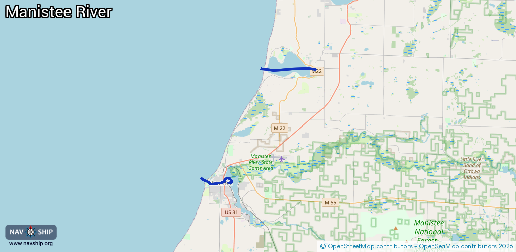
Inland
Driving areas:
🇺🇸 United States of America
Length:
10.4 km¹
¹River kilometers or bank length recorded in NavShip, including river arms and harbor entrances.
Availability:
Completely recorded
Recent Update: 14.05.2025²
² This date indicates when an adjustment last took place in the course of the body of water
Recorded:
Locks: 0
Harbours / marinas: 5
Bridges: 0
Berths: 0
Slipways: 1
Fuelstations: 4
Route:
Please wait, loading route graphic...
Request waterway overview map with symbol legend here (Link).
Information about data associated with this body of water (10 available):
Data by OpenSeaMap (c) OSM contributors, www.openseamap.org
| # | Kind | Coordinates | Name | Information |
|---|---|---|---|---|
| 1 | Marina | 44.35898,-86.26427 | 2021-01-12T13:05:21Z | |
| 2 | Marina | 44.36026,-86.26636 | 2021-01-12T13:05:21Z | |
| 3 | Marina | 44.24888,-86.31361 | 2021-06-24T19:06:57Z | Seng's Marina +1 231 723 9444 https://www.sengsmarina.com/ |
| 4 | Marina | 44.24762,-86.32736 | 2024-07-22T19:12:18Z | Manistee Municipal Marina http://www.manisteemi.gov/Facilities/Facility/Details/9 |
| 5 | Marina | 44.24831,-86.33011 | 2021-06-24T19:06:57Z | Shipwatch Marina |
| 6 | Slipway | 44.24727,-86.34009 | small_craft_facility | 2024-12-08T14:03:39Z 1st Street Boat Launch |
| 7 | Fuel station | 44.36169,-86.2046 | 2025-04-28T14:15:15Z | |
| 8 | Fuel station | 44.24877,-86.31336 | 2024-02-26T18:30:30Z | |
| 9 | Fuel station | 44.2478,-86.32697 | 2024-02-26T18:30:30Z | |
| 10 | Fuel station | 44.24824,-86.33056 | 2024-02-26T18:30:30Z |