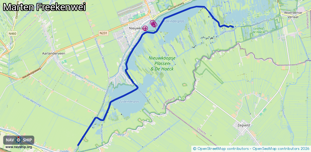
Waterway information

Kind:
Lower
Driving areas:
🇳🇱 Netherlands
Length:
10.3 km¹
¹River kilometers or bank length recorded in NavShip, including river arms and harbor entrances.
Availability:
Completely recorded
Recent Update: 04.03.2025²
² This date indicates when an adjustment last took place in the course of the body of water
Recorded:
Locks: 0
Harbours / marinas: 0
Bridges: 3
Berths: 0
Slipways: 0
Fuelstations: 0
Route:
Please wait, loading route graphic...
Request waterway overview map with symbol legend here (Link).
Information about data associated with this body of water (3 available):
Data by OpenSeaMap (c) OSM contributors, www.openseamap.org
| # | Kind | Coordinates | Name | Information |
|---|---|---|---|---|
| 1 | Bridge | 52.1293,4.77586 | 6.05 | Clearance height: 2020-06-12T14:52:58Z m Maximum passage width: 1.6 m Movable bridge (e.g. lifting bridge or drawbridge) opening Om de brug te openen heeft U een code nodig om het combinatieslot te kunnen openen. De code is verkrijgbaar bij de Ziendesluis of de Slikkendammersluis. tel: 06-21103938 / 06-21103939 |
| 2 | Bridge | 52.13126,4.7734 | 4.7 | Clearance height: 2020-11-03T19:39:02Z m Maximum passage width: 1 m fixed |
| 3 | Bridge | 52.13414,4.77027 | 4.7 | Clearance height: 2020-11-03T19:39:02Z m Maximum passage width: 1 m fixed |