Waterway information

Kind:
Inland
Driving areas:
🌊 Atlantic Ocean🇺🇸 United States of America
Length:
4.1 km¹
¹River kilometers or bank length recorded in NavShip, including river arms and harbor entrances.
Availability:
Completely recorded
Recent Update: 24.06.2025²
² This date indicates when an adjustment last took place in the course of the body of water
Recorded:
Locks: 0
Harbours / marinas: 6
Bridges: 0
Berths: 0
Slipways: 0
Fuelstations: 0
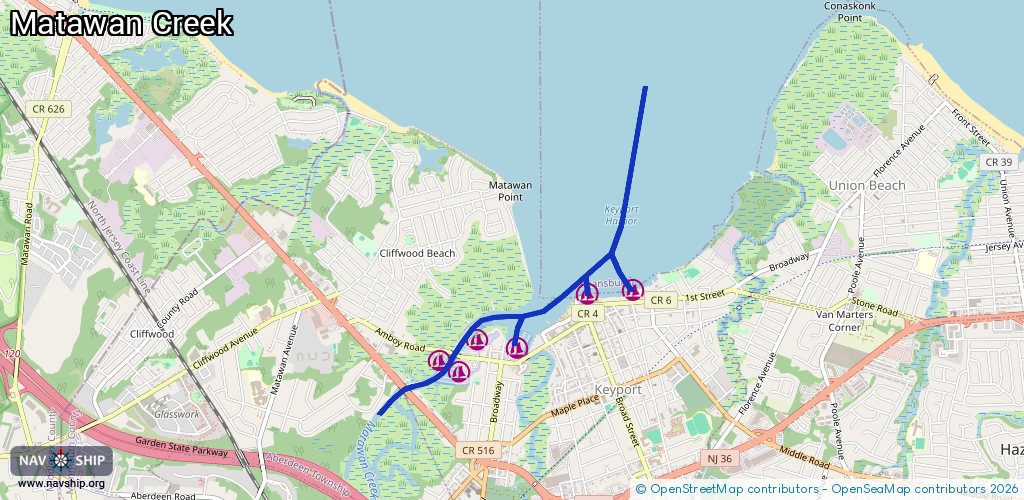
Route:
Please wait, loading route graphic...
Request waterway overview map with symbol legend here (Link).
Information about data associated with this body of water (6 available):
Data by OpenSeaMap (c) OSM contributors, www.openseamap.org
| # | Kind | Coordinates | Name | Information |
|---|---|---|---|---|
| 1 | Marina | 40.43931,-74.20224 | 2023-08-30T19:10:18Z | |
| 2 | Marina | 40.43947,-74.19833 | 2024-04-04T12:58:03Z | Keyport Yacht Club |
| 3 | Marina | 40.43627,-74.21179 | 2020-05-19T21:33:26Z | Brown's Point Marina |
| 4 | Marina | 40.43417,-74.21298 | 2020-05-19T21:33:26Z | |
| 5 | Marina | 40.43509,-74.21492 | 2020-05-19T21:33:26Z | Wagner's Marina |
| 6 | Marina | 40.43571,-74.20855 | 2025-11-09T11:48:39Z | Hans Pederson & Sons Marina +1-732-264-0971 http://hanspedersenandsons.com/ |