Waterway information

Kind:
Lake
Driving areas:
🇦🇹 Austria
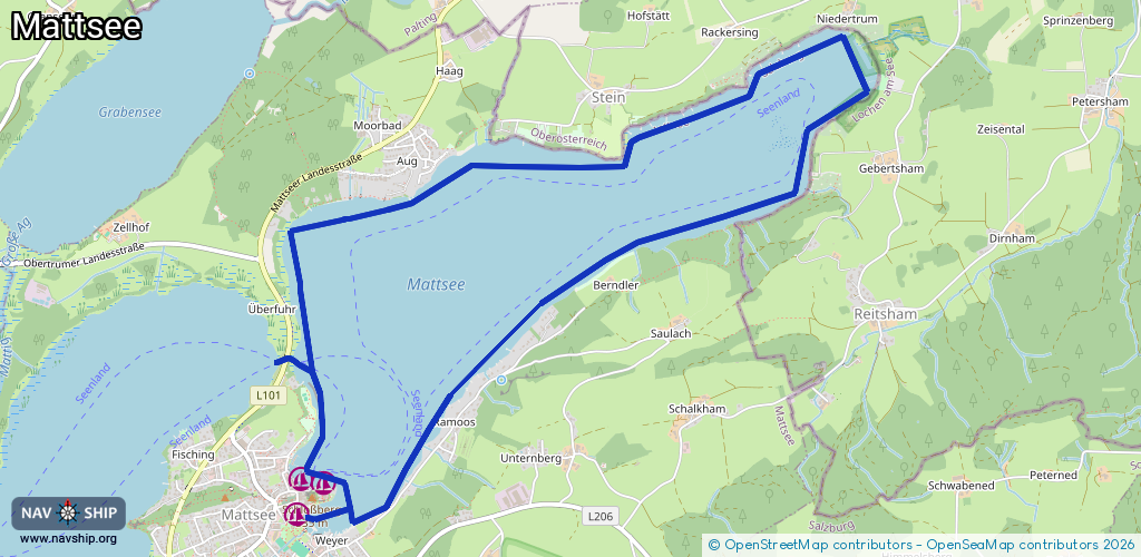
Length:
10.3 km¹
¹River kilometers or bank length recorded in NavShip, including river arms and harbor entrances.
Availability:
Completely recorded
Recent Update: 29.07.2024²
² This date indicates when an adjustment last took place in the course of the body of water
Recorded:
Locks: 0
Harbours / marinas: 3
Bridges: 0
Berths: 0
Slipways: 0
Fuelstations: 0
Route:
Please wait, loading route graphic...
Request waterway overview map with symbol legend here (Link).
Information about data associated with this body of water (3 available):
Data by OpenSeaMap (c) OSM contributors, www.openseamap.org
| # | Kind | Coordinates | Name | Information |
|---|---|---|---|---|
| 1 | Marina | 47.9716,13.10843 | 2022-07-09T07:46:53Z | Segelclub Mattsee http://www.segelclub-mattsee.at/ |
| 2 | Marina | 47.9718,13.1067 | 2023-11-08T14:26:12Z | Union Yacht Club Mattsee https://www.uyc-mattsee.at/ |
| 3 | Marina | 47.96992,13.10646 | 2021-04-29T21:54:07Z | Segelclub Mattsee Hafengelände |