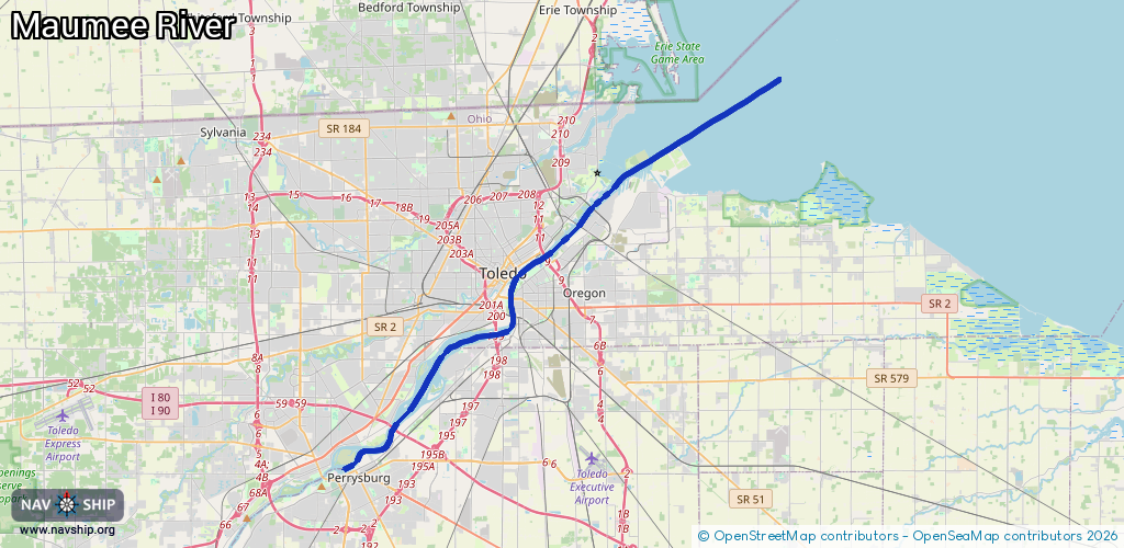
Waterway information

Kind:
Inland
Driving areas:
🇺🇸 United States of America
Length:
32.3 km¹
¹River kilometers or bank length recorded in NavShip, including river arms and harbor entrances.
Availability:
Completely recorded
Recent Update: 01.12.2023²
² This date indicates when an adjustment last took place in the course of the body of water
Recorded:
Locks: 0
Harbours / marinas: 8
Bridges: 0
Berths: 0
Slipways: 0
Fuelstations: 0
Route:
Please wait, loading route graphic...
Request waterway overview map with symbol legend here (Link).
Information about data associated with this body of water (8 available):
Data by OpenSeaMap (c) OSM contributors, www.openseamap.org
| # | Kind | Coordinates | Name | Information |
|---|---|---|---|---|
| 1 | Marina | 41.69307,-83.47533 | 2023-06-13T14:51:34Z | Toledo Yacht Club |
| 2 | Marina | 41.69573,-83.4757 | 2022-11-18T21:40:26Z | Bay View Yacht Club https://www.bvyc.org/ |
| 3 | Marina | 41.68683,-83.48287 | 2023-03-13T16:55:22Z | Brenner 75 Marine http://www.brenner75.com/site_page_2090/ |
| 4 | Marina | 41.65615,-83.51378 | 2021-06-28T17:46:12Z | |
| 5 | Marina | 41.62668,-83.54513 | 2020-08-21T20:13:09Z | Pier 75 Marina |
| 6 | Marina | 41.61237,-83.58412 | 2024-01-31T22:57:01Z | |
| 7 | Marina | 41.57128,-83.63814 | 2021-06-14T17:18:03Z | |
| 8 | Marina | 41.56098,-83.63173 | 2020-08-22T00:07:21Z |