Waterway information

Kind:
Inland
Driving areas:
🇩🇪 Germany🌊 North Sea
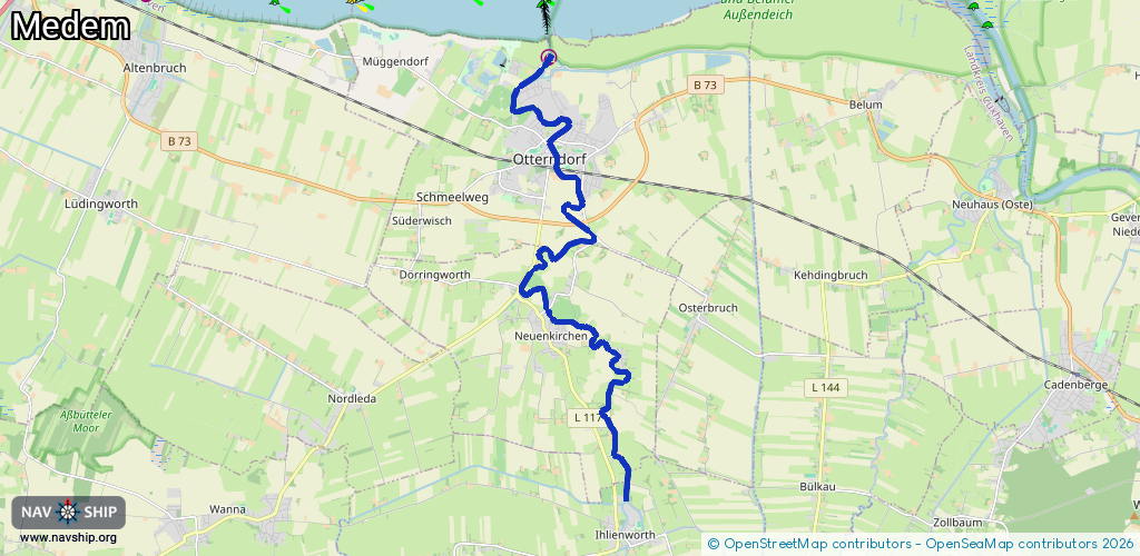
Length:
16.1 km¹
¹River kilometers or bank length recorded in NavShip, including river arms and harbor entrances.
Availability:
Completely recorded
Recent Update: 05.05.2025²
² This date indicates when an adjustment last took place in the course of the body of water
Recorded:
Locks: 1
Harbours / marinas: 1
Bridges: 0
Berths: 0
Slipways: 1
Fuelstations: 0
Route:
Please wait, loading route graphic...
Request waterway overview map with symbol legend here (Link).
Information about data associated with this body of water (3 available):
Data by OpenSeaMap (c) OSM contributors, www.openseamap.org
| # | Kind | Coordinates | Name | Information |
|---|---|---|---|---|
| 1 | Marina | 53.82578,8.89538 | 2023-03-28T11:57:58Z | Seglerhafen Otterndorf +49 160 91380232 seglerverein-otterndorf.de requires permission |
| 2 | Slipway | 53.82517,8.89402 | small_craft_facility | 2012-12-18T16:34:29Z |
| 3 | Lock | 53.82378,8.89314 | Unknown |