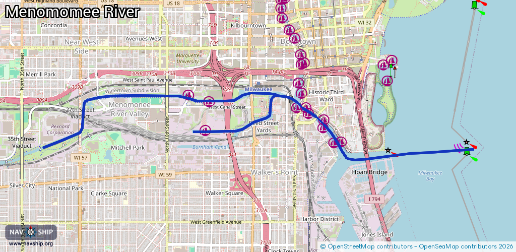
Waterway information

Kind:
Inland
Driving areas:
🇺🇸 United States of America
Length:
8.3 km¹
¹River kilometers or bank length recorded in NavShip, including river arms and harbor entrances.
Availability:
Completely recorded
Recent Update: 27.11.2023²
² This date indicates when an adjustment last took place in the course of the body of water
Recorded:
Locks: 0
Harbours / marinas: 7
Bridges: 0
Berths: 0
Slipways: 1
Fuelstations: 0
Route:
Please wait, loading route graphic...
Request waterway overview map with symbol legend here (Link).
Information about data associated with this body of water (8 available):
Data by OpenSeaMap (c) OSM contributors, www.openseamap.org
| # | Kind | Coordinates | Name | Information |
|---|---|---|---|---|
| 1 | Marina | 43.0269,-87.9047 | 2023-10-19T15:59:57Z | Hansen Marina +1-414-777-1875 |
| 2 | Marina | 43.02969,-87.90621 | 2023-10-20T22:42:45Z | |
| 3 | Marina | 43.0286,-87.90635 | 2021-10-31T00:00:28Z | |
| 4 | Marina | 43.03067,-87.90933 | 2021-10-30T10:51:34Z | |
| 5 | Marina | 43.0311,-87.9108 | 2023-05-03T18:54:55Z | |
| 6 | Marina | 43.02851,-87.92685 | 2021-10-31T00:00:28Z | |
| 7 | Marina | 43.03277,-87.92926 | 2021-10-31T00:00:28Z | |
| 8 | Slipway | 43.02865,-87.92712 | Unknown | 2021-01-07T20:58:10Z |