Waterway information

Kind:
Inland
Driving areas:
🌊 Atlantic Ocean🇬🇧 United Kingdom
Length:
116.9 km¹
¹River kilometers or bank length recorded in NavShip, including river arms and harbor entrances.
Availability:
Completely recorded
Recent Update: 09.04.2025²
² This date indicates when an adjustment last took place in the course of the body of water
Recorded:
Locks: 6
Harbours / marinas: 1
Bridges: 3
Berths: 0
Slipways: 2
Fuelstations: 0
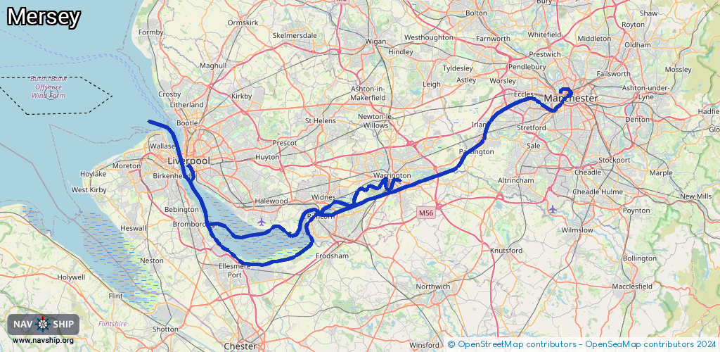
Route:
Please wait, loading route graphic...
Request waterway overview map with symbol legend here (Link).
Information about data associated with this body of water (11 available):
Data by OpenSeaMap (c) OSM contributors, www.openseamap.org
| # | Kind | Coordinates | Name | Information |
|---|---|---|---|---|
| 1 | Marina | 53.3908,-2.9848 | 2025-11-11T20:35:38Z | Liverpool Marina |
| 2 | Bridge | 53.39007,-2.50637 | Unknown | Clearance height: 2022-07-05T20:57:27Z m Movable bridge (e.g. lifting bridge or drawbridge) |
| 3 | Bridge | 53.39032,-2.50518 | Unknown | Clearance height: 2022-07-05T20:57:27Z m Movable bridge (e.g. lifting bridge or drawbridge) |
| 4 | Bridge | 53.40749,-2.45901 | Unknown | Clearance height: 2022-07-05T15:11:51Z m Movable bridge (e.g. lifting bridge or drawbridge) |
| 5 | Slipway | 53.39068,-2.98701 | small_craft_facility | 2025-11-13T06:42:25Z |
| 6 | Slipway | 53.3908,-2.98727 | small_craft_facility | 2014-09-08T07:34:04Z |
| 7 | Lock | 53.32245,-2.94798 | Unknown | |
| 8 | Lock | 53.3814,-2.54675 | Unknown | |
| 9 | Lock | 53.44292,-2.41113 | Unknown | |
| 10 | Lock | 53.4652,-2.38131 | Unknown | |
| 11 | Lock | 53.47379,-2.30543 | Unknown | |
| 11 | Lock | 53.47379,-2.30543 | Unknown |