Waterway information

Kind:
Inland
Driving areas:
🌊 Atlantic Ocean🇺🇸 United States of America
Length:
16.7 km¹
¹River kilometers or bank length recorded in NavShip, including river arms and harbor entrances.
Availability:
Completely recorded
Recent Update: 18.01.2024²
² This date indicates when an adjustment last took place in the course of the body of water
Recorded:
Locks: 0
Harbours / marinas: 9
Bridges: 0
Berths: 0
Slipways: 0
Fuelstations: 1
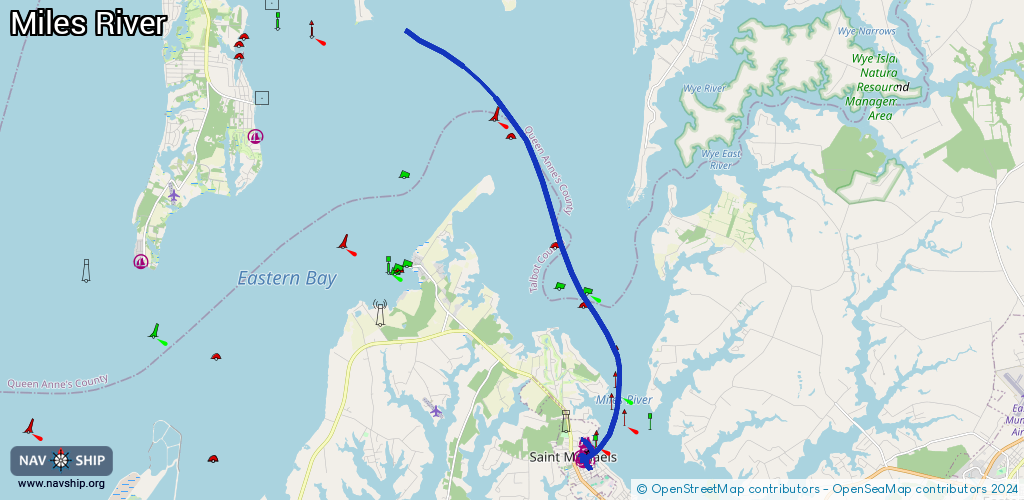
Route:
Please wait, loading route graphic...
Request waterway overview map with symbol legend here (Link).
Information about data associated with this body of water (10 available):
Data by OpenSeaMap (c) OSM contributors, www.openseamap.org
| # | Kind | Coordinates | Name | Information |
|---|---|---|---|---|
| 1 | Marina | 38.78786,-76.21922 | 2020-05-19T21:33:26Z | Thor |
| 2 | Marina | 38.78804,-76.21976 | 2025-01-01T20:16:13Z | Chesapeake Bay Maritime Museum [email protected] +1 410 745 4946 https://cbmm.org/visit/docking/ |
| 3 | Marina | 38.79085,-76.21983 | 2020-05-20T00:00:53Z | |
| 4 | Marina | 38.79059,-76.22102 | 2020-05-20T00:00:53Z | Inn at Perry Cabin |
| 5 | Marina | 38.78538,-76.21958 | 2025-01-01T20:16:13Z | Saint Michaels Harbour Inn, Marina and Spa [email protected] +1 410 745 9001 https://harbourinn.com |
| 6 | Marina | 38.78522,-76.221 | 2020-05-20T00:00:53Z | St. Michaels Marina +1 410 745 2400 https://stmichaelsmarina.com/ |
| 7 | Marina | 38.7991,-76.21918 | 2025-12-26T14:45:45Z | Miles River Yacht Club |
| 8 | Marina | 38.78697,-76.22171 | 2023-11-21T00:33:18Z | 07:00-23:00 |
| 9 | Marina | 38.78637,-76.22189 | 2020-05-20T00:00:53Z | Higgins Yacht Yard and Marina [email protected] +1 410 745 9303 https://higginsyachtyard.com/ |
| 10 | Fuel station | 38.78525,-76.22046 | 2020-05-20T00:00:53Z | St. Michaels Marina Ship Store |