Waterway information

Kind:
Inland
Driving areas:
🌊 Baltic Sea🇱🇹 Lithuania
Length:
44 km¹
¹River kilometers or bank length recorded in NavShip, including river arms and harbor entrances.
Availability:
Completely recorded
Recent Update: 05.04.2025²
² This date indicates when an adjustment last took place in the course of the body of water
Recorded:
Locks: 1
Harbours / marinas: 4
Bridges: 0
Berths: 0
Slipways: 1
Fuelstations: 0
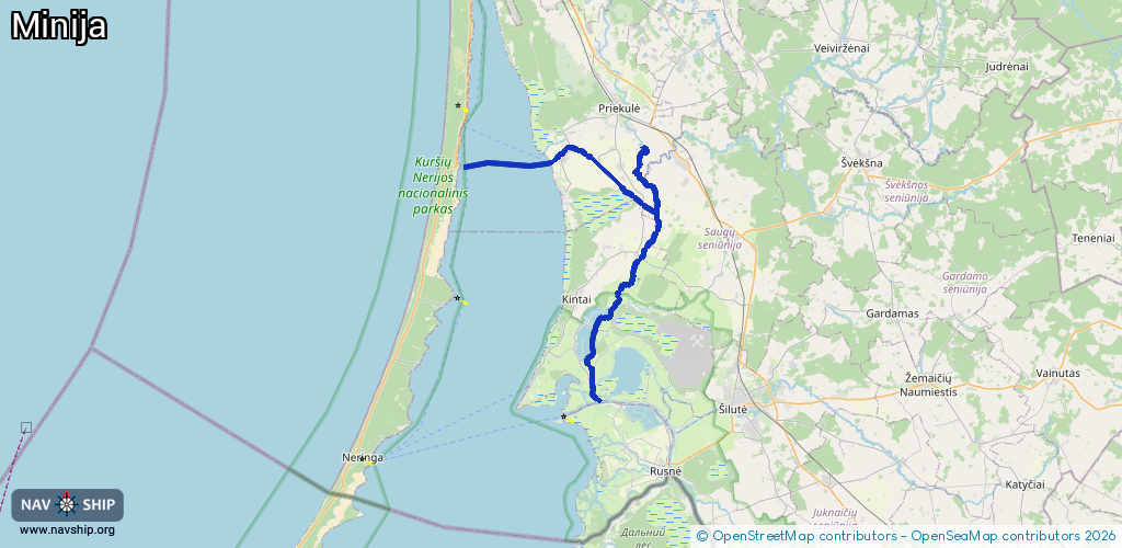
Route:
Please wait, loading route graphic...
Request waterway overview map with symbol legend here (Link).
Information about data associated with this body of water (5 available):
Data by OpenSeaMap (c) OSM contributors, www.openseamap.org
| # | Kind | Coordinates | Name | Information |
|---|---|---|---|---|
| 1 | Marina | 55.51763,21.23647 | 2025-09-12T13:22:08Z | Dreverna +370441473416 |
| 2 | Marina | 55.39933,21.28724 | 2023-11-02T19:32:55Z | https://www.kintai.lt/ |
| 3 | Marina | 55.35891,21.28374 | 2025-08-30T11:30:48Z | Keltas į NIDĄ |
| 4 | Marina | 55.35805,21.28341 | 2025-01-01T22:17:54Z | Minijos jachtklubas [email protected] +37063142510 https://minija.com |
| 5 | Slipway | 55.35782,21.28259 | small_craft_facility | 2021-07-15T16:01:22Z |
| 5 | Slipway | 55.35782,21.28259 | small_craft_facility | 2021-07-15T16:01:22Z |