Waterway information

Kind:
Inland
Driving areas:
🌊 Atlantic Ocean🇺🇸 United States of America
Length:
3090.3 km¹, 3778 km official total length
¹River kilometers or bank length recorded in NavShip, including river arms and harbor entrances.
Availability:
Completely recorded
Recent Update: 10.07.2025²
² This date indicates when an adjustment last took place in the course of the body of water
Recorded:
Locks: 20
Harbours / marinas: 125
Bridges: 0
Berths: 10
Slipways: 5
Fuelstations: 1
Useful information:
The "Ol' Man River" symbolizes the deep south of the United States.
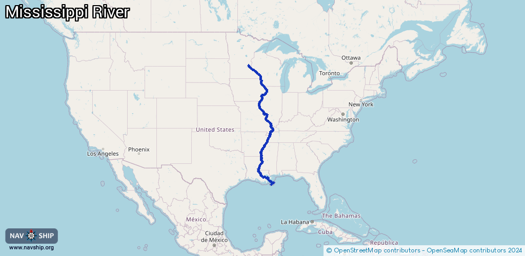
The Mississippi River, short Mississippi, is an approximately 3,800 km long river that flows through the states of Minnesota, Wisconsin, Iowa, Illinois, Missouri, Kentucky, Tennessee, Arkansas, Mississippi and Louisiana. Together with the Missouri River, the lower reaches of the Mississippi form the fourth longest river system in the world, the "Mississippi-Missouri", with a length of over 6,000 km.
It provides the state of the South with its name. The name was borrowed from the Native American Algonquin language and means no more and no less than "Great River" or "Father of Rivers".
Anyone traveling upstream by steamer can hardly get enough of the endless landscape with its rolling hills, cotton fields and sugar cane. The scent of magnolias fills the air during stops in the sleepy-looking little villages.
Route:
Please wait, loading route graphic...
Request waterway overview map with symbol legend here (Link).
Information about data associated with this body of water (161 available):
Data by OpenSeaMap (c) OSM contributors, www.openseamap.org
| # | Kind | Coordinates | Name | Information |
|---|
| 1 | Marina | 38.93215,-90.47647 | Polestar Marina and Uncharted Service | |
| 2 | Marina | 38.93391,-90.47584 | Port Charles Harbour | |
| 3 | Marina | 38.93719,-90.47361 | Unknown | |
| 4 | Marina | 29.38771,-89.60595 | Unknown | |
| 5 | Marina | 29.3876,-89.60592 | Unknown | |
| 6 | Marina | 29.38576,-89.60419 | Unknown | |
| 7 | Marina | 29.38512,-89.6039 | Unknown | |
| 8 | Marina | 29.38562,-89.60121 | Unknown | |
| 9 | Marina | 29.38648,-89.60183 | Unknown | |
| 10 | Marina | 29.38679,-89.60229 | Unknown | |
| 11 | Marina | 29.38628,-89.59942 | Unknown | |
| 12 | Marina | 29.38611,-89.59991 | Unknown | |
| 13 | Marina | 29.38662,-89.59931 | Unknown | |
| 14 | Marina | 29.26227,-89.35334 | Unknown | |
| 15 | Marina | 29.26103,-89.35877 | Unknown | |
| 16 | Marina | 29.26238,-89.36009 | Unknown | |
| 17 | Marina | 29.26608,-89.35329 | US Fish and Wildlife | |
| 18 | Marina | 29.26646,-89.35447 | Unknown | |
| 19 | Marina | 29.26535,-89.35343 | Unknown | |
| 20 | Marina | 29.26389,-89.35316 | Unknown | |
| 21 | Marina | 29.2672,-89.35413 | Unknown | |
| 22 | Marina | 29.26786,-89.35447 | Unknown | |
| 23 | Marina | 29.26873,-89.35284 | Unknown | |
| 24 | Marina | 29.26989,-89.35205 | Unknown | |
| 25 | Marina | 29.27235,-89.35198 | Unknown | |
| 26 | Marina | 29.27298,-89.35204 | Federal Marina | |
| 27 | Marina | 42.46942,-90.61423 | Fentress Lake Marina | |
| 28 | Marina | 43.09407,-91.14819 | Unknown | |
| 29 | Marina | 29.21045,-89.28921 | Pilottown Anchorages (3.3) | |
| 30 | Marina | 29.2645,-89.3289 | Lower Venice Anchorages (9.0) | |
| 31 | Marina | 29.2774,-89.34344 | Upper Venice Anchorages (10.5) | |
| 32 | Marina | 29.2855,-89.36051 | Associated Branch Pilots | |
| 33 | Marina | 29.28518,-89.36046 | Associated Branch Pilots | |
| 34 | Marina | 29.28926,-89.36333 | Plains Venice | |
| 35 | Marina | 29.3342,-89.40454 | Boothville Anchorages (15.4) | |
| 36 | Marina | 29.35471,-89.46029 | Unknown | |
| 37 | Marina | 29.35289,-89.51231 | Ostrica Anchorages (23.2) | |
| 38 | Marina | 29.37274,-89.55261 | Chevron Empire | |
| 39 | Marina | 29.47305,-89.67306 | Port Sulpur Anchorages (38) | |
| 40 | Marina | 29.49656,-89.69711 | Unknown | |
| 41 | Marina | 29.50493,-89.71218 | Port Michel Anchorages (41.5) | |
| 42 | Marina | 29.54407,-89.76895 | BCMT Magnolia Dock | |
| 43 | Marina | 29.54381,-89.7692 | Unknown | |
| 44 | Marina | 29.54963,-89.77309 | Magnolia Anchorages (46.6) | |
| 45 | Marina | 29.58019,-89.80115 | Unknown | |
| 46 | Marina | 29.58585,-89.82166 | Celeste Anchorages (50.9) | |
| 47 | Marina | 29.59384,-89.83704 | Unknown | |
| 48 | Marina | 29.59967,-89.84973 | Unknown | |
| 49 | Marina | 29.60627,-89.8512 | Celeste Anchorages (50.9) | |
| 50 | Marina | 29.60208,-89.86134 | BCMT Davant Launch | |
| 51 | Marina | 29.60357,-89.87084 | Unknown | |
| 52 | Marina | 29.60282,-89.86677 | Unknown | |
| 53 | Marina | 29.60639,-89.88043 | Venture Global Plaquemines | |
| 54 | Marina | 29.61214,-89.87651 | Davant Anchorages (53.4) | |
| 55 | Marina | 29.61797,-89.89219 | UBT Davant | |
| 56 | Marina | 29.62229,-89.90071 | Unknown | |
| 57 | Marina | 29.6192,-89.90983 | Unknown | |
| 58 | Marina | 29.62558,-89.91933 | IMT | |
| 59 | Marina | 29.63307,-89.9174 | Unknown | |
| 60 | Marina | 29.63501,-89.93632 | Unknown | |
| 61 | Marina | 29.63707,-89.94183 | Unknown | |
| 62 | Marina | 29.66285,-89.96257 | Dockages | |
| 63 | Marina | 29.67043,-89.96325 | Unknown | |
| 64 | Marina | 29.67524,-89.9651 | Unknown | |
| 65 | Marina | 29.68014,-89.9671 | Unknown | |
| 66 | Marina | 29.68437,-89.96284 | Unknown | |
| 67 | Marina | 29.6845,-89.97 | Unknown | |
| 68 | Marina | 29.6917,-89.97589 | Unknown | |
| 69 | Marina | 29.69999,-89.97311 | Unknown | |
| 70 | Marina | 29.70148,-89.98373 | BCMT LaGrange Launch | |
| 71 | Marina | 29.71186,-89.98757 | La Grange Anchorages (64.8) | |
| 72 | Marina | 29.74677,-90.01069 | Willis Point Anchorages (67.1) | |
| 73 | Marina | 29.79957,-90.0117 | Dockside Buoys | |
| 74 | Marina | 29.8094,-90.00768 | Unknown | |
| 75 | Marina | 29.81787,-90.00585 | Unknown | |
| 76 | Marina | 29.82665,-90.00296 | Belle Chasse Marine Transporation | |
| 77 | Marina | 29.83218,-89.99684 | Belle Chasse Anchorages (74.2) | |
| 78 | Marina | 29.84775,-89.97792 | Unknown | |
| 79 | Marina | 29.8546,-89.98188 | PPHTD Boatyard | |
| 80 | Marina | 29.85483,-89.9814 | Plaquemines Port Harbor and Terminal District | |
| 81 | Marina | 29.86069,-89.97255 | Unknown | |
| 82 | Marina | 29.877,-89.94501 | 12 Mile Anchorages | |
| 83 | Marina | 29.87056,-89.94463 | Unknown | |
| 84 | Marina | 38.88522,-90.17772 | Alton Marina | |
| 85 | Marina | 39.46138,-91.04277 | Two Rivers Marina | |
| 86 | Marina | 39.71049,-91.35268 | Nipper Marina | |
| 87 | Marina | 40.38769,-91.3872 | Southside Boat Club | Mo-Fr 15:00-22:00, Sa-Su 12:00-22:00+ needs confirmation, original said just noon-close
319-524-7122 |
| 88 | Marina | 40.42103,-91.38429 | Keokuk Yacht Club | |
| 89 | Marina | 40.62888,-91.30253 | Riverview Marina | |
| 90 | Marina | 40.81918,-91.09933 | Bluff Harbor Marina | |
| 91 | Marina | 41.4454,-90.72112 | Unknown | |
| 92 | Marina | 41.47477,-90.64562 | Unknown | |
| 93 | Marina | 41.48607,-90.60489 | Sunset Marina | |
| 94 | Marina | 41.52189,-90.50493 | Oasis Marina | |
| 95 | Marina | 41.56032,-90.41074 | Safe Harbour | |
| 96 | Marina | 42.06074,-90.17055 | Unknown | |
| 97 | Marina | 42.08908,-90.15491 | Savanna Marina | +1-815-273-2955
https://www.savanna-il.us/mississippiriver.php |
| 98 | Marina | 42.30188,-90.43441 | Spruce Harbor | |
| 99 | Marina | 42.47831,-90.64024 | Millenium Marina | |
| 100 | Marina | 42.48568,-90.64697 | Mid-Town Marina | |
| 101 | Marina | 42.4955,-90.66018 | Port of Dubuque Marina | |
| 102 | Marina | 42.49603,-90.65603 | Public Boat Dock | |
| 103 | Marina | 42.51162,-90.649 | Unknown | |
| 104 | Marina | 42.52056,-90.64692 | Dubuque Water Sports Club | |
| 105 | Marina | 42.52636,-90.64444 | Dubuque Marina | |
| 106 | Marina | 43.02638,-91.17276 | Unknown | |
| 107 | Marina | 43.79744,-91.25893 | Unknown | |
| 108 | Marina | 44.05192,-91.62357 | Winona Marina | |
| 109 | Marina | 44.06089,-91.64217 | Unknown | |
| 110 | Marina | 44.34044,-91.93181 | Alma Marina | |
| 111 | Marina | 44.56497,-92.54536 | Unknown | |
| 112 | Marina | 44.56588,-92.55011 | Unknown | |
| 113 | Marina | 44.74297,-92.79576 | Miss Croix Yacht Harbor | |
| 114 | Marina | 44.74542,-92.7986 | PRESCOTT BOAT LAUNCH | |
| 115 | Marina | 44.74459,-92.79836 | Unknown | |
| 116 | Marina | 44.75168,-92.81342 | Point Douglas Marina | |
| 117 | Marina | 44.7454,-92.83791 | Hastings Marina | |
| 118 | Marina | 44.75058,-92.85516 | Captains Bay Marina (Hub's) | |
| 119 | Marina | 44.75537,-92.84923 | Unknown | |
| 120 | Marina | 44.8958,-93.1677 | Watergate Marina | |
| 121 | Marina | 44.49855,-92.31519 | Hansen's Harbor | |
| 122 | Marina | 35.15075,-90.05662 | Harbor Landing | |
| 123 | Marina | 43.05976,-91.15155 | Unknown | |
| 124 | Marina | 43.06131,-91.15382 | Unknown | |
| 125 | Marina | 44.44999,-92.26313 | Lake City Marina | https://www.ci.lake-city.mn.us/marina |
| 126 | Slipway | 42.5256,-90.64238 | A.Y. McDonald Park Boat Ramp | small_craft_facility |
| 127 | Slipway | 44.74967,-92.85425 | Unknown | |
| 128 | Slipway | 44.75525,-92.8517 | Unknown | |
| 129 | Slipway | 44.84326,-93.00651 | Unknown | |
| 130 | Slipway | 44.84232,-93.00616 | Unknown | |
| 131 | Berth | 38.58715,-90.2092 | USCGC Cheyenne | The USCGC Cheyenne is a 75 ft. river buoy tender that maintains buoys and other aids to navigation on the Upper Mississippi River, from Chester IL, to Alton, IL, the Missouri River to Glasgow, MO, and the Kaskaskia River New Athens, IL.
https://www.facebook.com/MCPOCG/photos/pcb.1083440222102071/1083439688768791/?type=3&,theater |
| 132 | Berth | 38.58781,-90.20827 | USCGC Gasconade | USCGC Gasconade is a 75' river buoy tender that maintains buoys and other aids to navigation on the Missouri River from Hamilton, IL to Sioux City, IA. |
| 133 | Berth | 38.59,-90.20513 | Dredge Potter | |
| 134 | Berth | 38.58875,-90.20694 | M/V Grand Tower | |
| 135 | Berth | 40.38816,-91.38389 | USCGC Scioto | USCGC Scioto is a 65' river buoy tender that maintains buoys and other aids to navigation on the Mississippi River from Alton, IL to Clinton, IA. |
| 136 | Berth | 41.57656,-90.40356 | M/V Rock Island | |
| 137 | Berth | 42.49469,-90.66124 | WLR-75403 | USCGC Wyaconda is a 75' river buoy tender that maintains buoys and other aids to navigation on the Mississippi River from Clinton, IA to Minneapolis, MN, the Minnesota River to Shakopee, MN, and the St. Croix River to Stillwater, MN. |
| 138 | Berth | 44.13618,-91.7262 | Dredge Goetz | |
| 139 | Berth | 44.13642,-91.7265 | M/V GENERAL WARREN | |
| 140 | Berth | 35.15889,-90.05041 | USCGC Kankakee | USCGC Kankakee is a 75' river buoy tender that maintains buoys and other aids to navigation on the Lower Mississippi River, from mile 683 to mile 813.6. |
| 141 | Fuel station | 42.49551,-90.66067 | Unknown | |
| 142 | Lock | 29.38875,-89.59672 | null | |
| 143 | Lock | 39.00401,-90.68941 | Unknown | |
| 144 | Lock | 39.37404,-90.90624 | Unknown | |
| 145 | Lock | 39.63575,-91.24912 | Unknown | |
| 146 | Lock | 39.90312,-91.42912 | Unknown | |
| 147 | Lock | 40.14368,-91.51541 | Unknown | |
| 148 | Lock | 40.39464,-91.37548 | Unknown | |
| 149 | Lock | 40.88208,-91.02375 | Unknown | |
| 150 | Lock | 41.42509,-91.01012 | Unknown | |
| 151 | Lock | 41.89737,-90.15495 | Unknown | |
| 152 | Lock | 42.53996,-90.64583 | Unknown | |
| 153 | Lock | 42.78513,-91.09533 | Unknown | |
| 154 | Lock | 43.21128,-91.09968 | Unknown | |
| 155 | Lock | 43.86537,-91.30894 | Unknown | |
| 156 | Lock | 43.99939,-91.43651 | Unknown | |
| 157 | Lock | 44.60983,-92.60921 | Unknown | |
| 158 | Lock | 44.75947,-92.86829 | Unknown | |
| 159 | Lock | 44.91461,-93.20224 | Unknown | |
| 160 | Lock | 44.97866,-93.24667 | Unknown | |
| 161 | Lock | 44.98101,-93.2574 | Unknown | |