Waterway information

Kind:
Lower
Driving areas:
🇩🇪 Germany
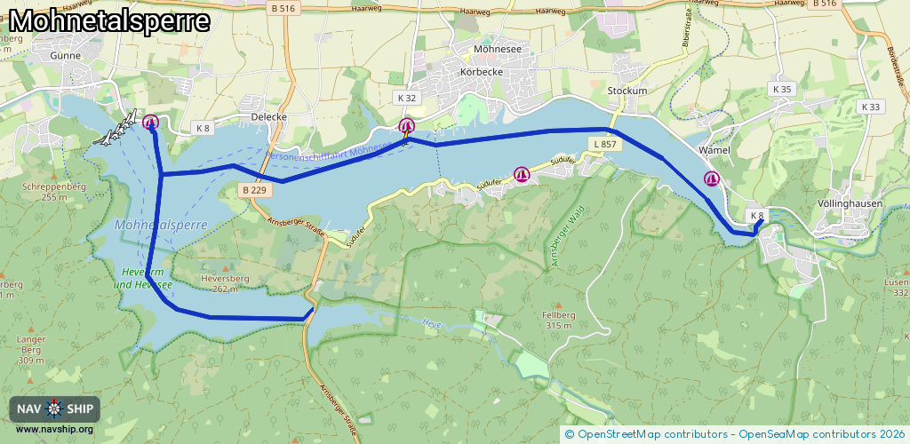
Length:
13.4 km¹
¹River kilometers or bank length recorded in NavShip, including river arms and harbor entrances.
Availability:
Completely recorded
Recent Update: 28.08.2024²
² This date indicates when an adjustment last took place in the course of the body of water
Recorded:
Locks: 0
Harbours / marinas: 4
Bridges: 0
Berths: 0
Slipways: 0
Fuelstations: 0
Route:
Please wait, loading route graphic...
Request waterway overview map with symbol legend here (Link).
Information about data associated with this body of water (4 available):
Data by OpenSeaMap (c) OSM contributors, www.openseamap.org
| # | Kind | Coordinates | Name | Information |
|---|---|---|---|---|
| 1 | Marina | 51.48428,8.17475 | 2024-08-21T12:41:22Z | Yachtclub Sauerland |
| 2 | Marina | 51.48482,8.138 | 2025-03-28T16:21:58Z | RFCM http://www.rfcm.de/index.html |
| 3 | Marina | 51.49066,8.11576 | 2022-07-23T15:19:34Z | Yachtclub Westfalia Arnsberg e.V. |
| 4 | Marina | 51.49108,8.06628 | 2021-06-13T03:17:32Z | Yachtclub Möhnesee |