Waterway information

Kind:
Inland
Driving areas:
🇦🇺 Australia
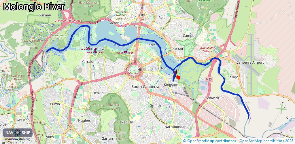
Length:
17.7 km¹
¹River kilometers or bank length recorded in NavShip, including river arms and harbor entrances.
Availability:
Completely recorded
Recent Update: 06.03.2025²
² This date indicates when an adjustment last took place in the course of the body of water
Recorded:
Locks: 0
Harbours / marinas: 0
Bridges: 2
Berths: 3
Slipways: 0
Fuelstations: 0
Route:
Please wait, loading route graphic...
Request waterway overview map with symbol legend here (Link).
Information about data associated with this body of water (5 available):
Data by OpenSeaMap (c) OSM contributors, www.openseamap.org
| # | Kind | Coordinates | Name | Information |
|---|---|---|---|---|
| 1 | Bridge | -35.30178,149.14092 | Unknown | Clearance height: 2025-03-03T12:09:57Z m Movable bridge (e.g. lifting bridge or drawbridge) fixed |
| 2 | Bridge | -35.29288,149.12689 | Unknown | Clearance height: 2025-03-03T12:09:57Z m Movable bridge (e.g. lifting bridge or drawbridge) fixed |
| 3 | Berth | -35.2997,149.11938 | 2025-03-03T12:09:57Z | small_craft_mooring |
| 4 | Berth | -35.29943,149.10111 | 2025-03-03T12:09:57Z | small_craft_mooring |
| 5 | Berth | -35.298,149.09724 | 2025-03-03T12:09:57Z | small_craft_mooring |