Waterway information

Kind:
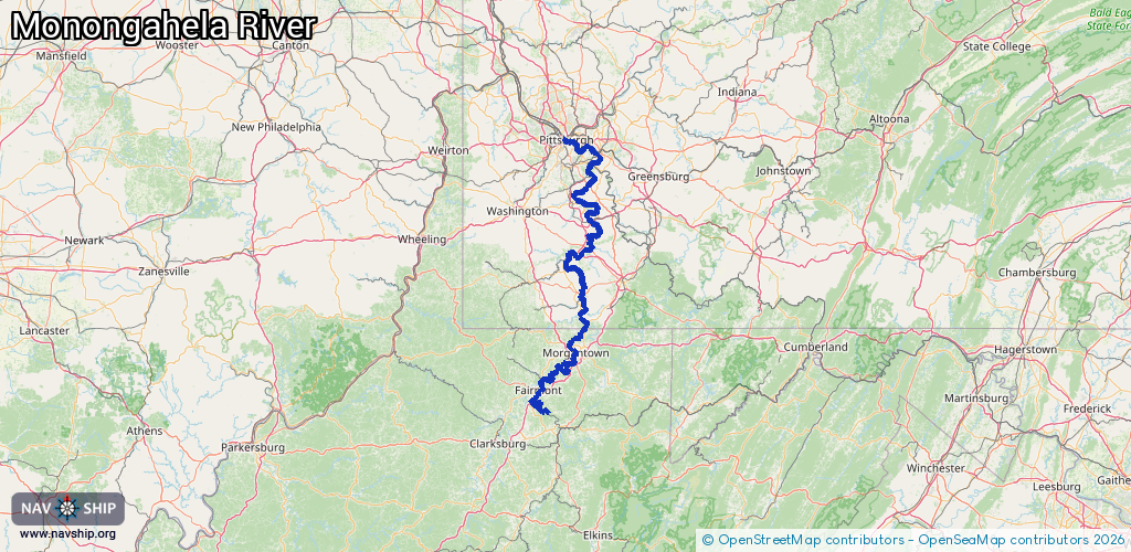
Inland
Driving areas:
🇺🇸 United States of America
Length:
226.6 km¹
¹River kilometers or bank length recorded in NavShip, including river arms and harbor entrances.
Availability:
Completely recorded
Recent Update: 27.09.2023²
² This date indicates when an adjustment last took place in the course of the body of water
Recorded:
Locks: 9
Harbours / marinas: 1
Bridges: 0
Berths: 0
Slipways: 0
Fuelstations: 0
Route:
Please wait, loading route graphic...
Request waterway overview map with symbol legend here (Link).
Information about data associated with this body of water (10 available):
Data by OpenSeaMap (c) OSM contributors, www.openseamap.org
| # | Kind | Coordinates | Name | Information |
|---|---|---|---|---|
| 1 | Marina | 40.20105,-79.91748 | 2022-10-31T19:31:48Z | |
| 2 | Lock | 39.56519,-80.04925 | Unknown | |
| 3 | Lock | 39.58207,-80.01151 | Unknown | |
| 4 | Lock | 39.62074,-79.96923 | Unknown | |
| 5 | Lock | 39.72681,-79.91296 | Unknown | |
| 6 | Lock | 39.82445,-79.92092 | Unknown | |
| 7 | Lock | 40.00063,-79.96035 | Unknown | |
| 8 | Lock | 40.14716,-79.89928 | Unknown | |
| 9 | Lock | 40.26488,-79.89849 | Unknown | |
| 10 | Lock | 40.39186,-79.85913 | Unknown |