Waterway information

Kind:
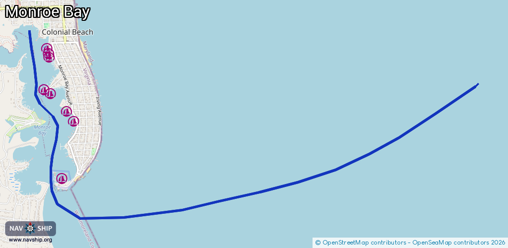
Inland
Driving areas:
🇺🇸 United States of America
Length:
9.7 km¹
¹River kilometers or bank length recorded in NavShip, including river arms and harbor entrances.
Availability:
Completely recorded
Recent Update: 18.01.2024²
² This date indicates when an adjustment last took place in the course of the body of water
Recorded:
Locks: 0
Harbours / marinas: 8
Bridges: 0
Berths: 0
Slipways: 0
Fuelstations: 0
Route:
Please wait, loading route graphic...
Request waterway overview map with symbol legend here (Link).
Information about data associated with this body of water (8 available):
Data by OpenSeaMap (c) OSM contributors, www.openseamap.org
| # | Kind | Coordinates | Name | Information |
|---|---|---|---|---|
| 1 | Marina | 38.23085,-76.96369 | 2020-05-19T21:33:26Z | Colonial Beach Yacht Center https://www.cbycmarina.com/ |
| 2 | Marina | 38.23908,-76.96178 | 2023-04-20T20:38:30Z | Parkers Marina |
| 3 | Marina | 38.24056,-76.96293 | 2020-05-19T21:33:26Z | The Boat House Marina http://theboathousemarina-va.com/ |
| 4 | Marina | 38.24271,-76.96586 | 2022-07-18T15:41:17Z | Winkie Doodle Point Marina |
| 5 | Marina | 38.24351,-76.96672 | 2022-07-18T15:41:17Z | Monroe Bay Marina http://monroebaymarina.com/ |
| 6 | Marina | 38.2478,-76.9659 | 2020-05-19T21:33:26Z | Ice House Marina https://www.icehousecb.com/ |
| 7 | Marina | 38.24889,-76.96653 | 2024-11-10T13:34:29Z | Bayside Marina http://www.baysidemarina.org |
| 8 | Marina | 38.24825,-76.96596 | 2020-05-19T21:33:26Z | Nightingale Marina |