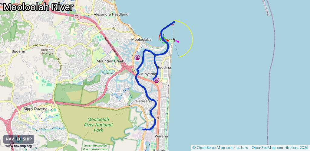
Waterway information

Kind:
Inland
Driving areas:
🇦🇺 Australia🌊 Pacific Ocean
Length:
11 km¹
¹River kilometers or bank length recorded in NavShip, including river arms and harbor entrances.
Availability:
Completely recorded
Recent Update: 20.05.2025²
² This date indicates when an adjustment last took place in the course of the body of water
Recorded:
Locks: 0
Harbours / marinas: 2
Bridges: 0
Berths: 0
Slipways: 0
Fuelstations: 1
Route:
Please wait, loading route graphic...
Request waterway overview map with symbol legend here (Link).
Information about data associated with this body of water (3 available):
Data by OpenSeaMap (c) OSM contributors, www.openseamap.org
| # | Kind | Coordinates | Name | Information |
|---|---|---|---|---|
| 1 | Marina | -26.70041,153.12846 | 2023-10-13T03:38:56Z | Lawrie's Boat Services +61 7 5478 1350 https://lawriesboatservices.com.au/ |
| 2 | Marina | -26.68893,153.11779 | 2022-08-29T04:20:18Z | Baronga Broadwater |
| 3 | Fuel station | -26.69921,153.12801 | 2025-12-13T09:35:33Z | Chippo's Fuel Supply Chippo's Fuel on water diesel supply Mo-Su 06:00-18:00 https://chippos-fuel-supplies.business.sit e/ |