Waterway information

Kind:
Inland
Driving areas:
🇨🇿 Czech Republic
Length:
14.8 km¹
¹River kilometers or bank length recorded in NavShip, including river arms and harbor entrances.
Availability:
Completely recorded
Recent Update: 21.08.2023²
² This date indicates when an adjustment last took place in the course of the body of water
Recorded:
Locks: 0
Harbours / marinas: 4
Bridges: 0
Berths: 0
Slipways: 0
Fuelstations: 0
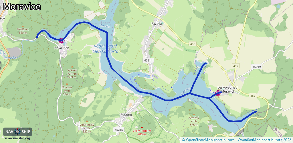
Route:
Please wait, loading route graphic...
Request waterway overview map with symbol legend here (Link).
Information about data associated with this body of water (4 available):
Data by OpenSeaMap (c) OSM contributors, www.openseamap.org
| # | Kind | Coordinates | Name | Information |
|---|---|---|---|---|
| 1 | Marina | 49.90468,17.56923 | 2023-06-10T12:26:25Z | Leskovec nad Moravicí |
| 2 | Marina | 49.9041,17.56866 | 2020-11-02T21:24:25Z | Leskovec - Slezská Harta |
| 3 | Marina | 49.92455,17.47506 | 2020-07-25T08:27:03Z | Nová Pláň - Slezská Harta |
| 4 | Marina | 49.92481,17.47532 | 2020-07-25T08:29:27Z | Nová Pláň - kotviště |