Waterway information

Kind:
Inland
Driving areas:
🌊 Atlantic Ocean🇫🇷 France
Length:
8 km¹
¹River kilometers or bank length recorded in NavShip, including river arms and harbor entrances.
Availability:
Completely recorded
Recent Update: 03.04.2025²
² This date indicates when an adjustment last took place in the course of the body of water
Recorded:
Locks: 1
Harbours / marinas: 4
Bridges: 0
Berths: 0
Slipways: 1
Fuelstations: 1
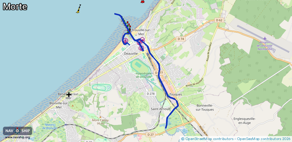
Route:
Please wait, loading route graphic...
Request waterway overview map with symbol legend here (Link).
Information about data associated with this body of water (7 available):
Data by OpenSeaMap (c) OSM contributors, www.openseamap.org
| # | Kind | Coordinates | Name | Information |
|---|---|---|---|---|
| 1 | Marina | 49.36457,0.07108 | 2024-07-29T13:25:48Z | Marina de Deauville |
| 2 | Marina | 49.36479,0.08155 | 2016-04-11T13:05:10Z | Trouville-sur-Mer |
| 3 | Marina | 49.36216,0.08045 | 2023-07-24T08:59:26Z | Bassin Morny |
| 4 | Marina | 49.36375,0.07969 | 2021-02-06T13:17:13Z | Bassin des Yachts |
| 5 | Slipway | 49.36429,0.07677 | small_craft_facility | 2021-02-06T13:17:13Z Deauville |
| 6 | Fuel station | 49.36669,0.07035 | 2024-07-29T13:25:48Z | Port Deauville |
| 7 | Lock | 49.36696,0.07081 | Unknown |