Waterway information

Kind:
Inland
Driving areas:
🌊 Baltic Sea🌊 North Sea🇳🇴 Norway
Length:
4.3 km¹
¹River kilometers or bank length recorded in NavShip, including river arms and harbor entrances.
Availability:
Completely recorded
Recent Update: 24.01.2024²
² This date indicates when an adjustment last took place in the course of the body of water
Recorded:
Locks: 0
Harbours / marinas: 4
Bridges: 0
Berths: 0
Slipways: 0
Fuelstations: 0
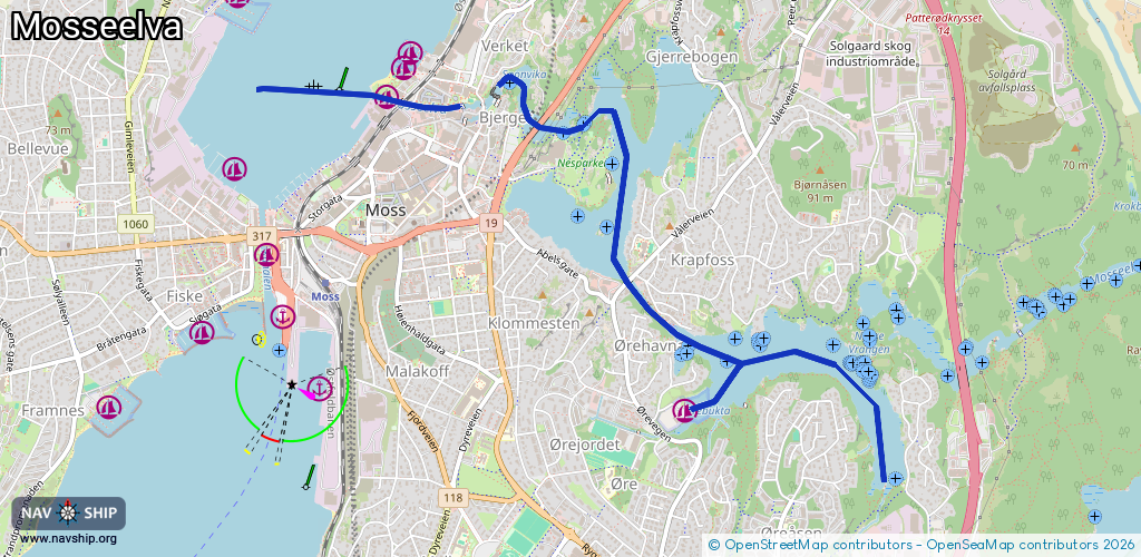
Route:
Please wait, loading route graphic...
Request waterway overview map with symbol legend here (Link).
Information about data associated with this body of water (4 available):
Data by OpenSeaMap (c) OSM contributors, www.openseamap.org
| # | Kind | Coordinates | Name | Information |
|---|---|---|---|---|
| 1 | Marina | 59.4403,10.66347 | 2025-10-25T06:35:01Z | Verket gjestehavn https://baathavn.verketmoss.no/ |
| 2 | Marina | 59.44087,10.66417 | 2025-10-25T06:50:13Z | Verket småbåthavn https://baathavn.verketmoss.no/ |
| 3 | Marina | 59.43922,10.66205 | 2025-02-22T15:42:55Z | Verket gjestehavn https://baathavn.verketmoss.no/ |
| 4 | Marina | 59.42688,10.68543 | 2024-12-05T10:02:30Z | Vansjø båtforening https://www.havneweb.no/vansjo/ |