Waterway information

Kind:
Inland
Driving areas:
🇺🇸 United States of America
Length:
4.2 km¹
¹River kilometers or bank length recorded in NavShip, including river arms and harbor entrances.
Availability:
Completely recorded
Recent Update: 22.01.2025²
² This date indicates when an adjustment last took place in the course of the body of water
Recorded:
Locks: 0
Harbours / marinas: 7
Bridges: 0
Berths: 0
Slipways: 0
Fuelstations: 0
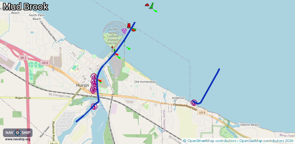
Route:
Please wait, loading route graphic...
Request waterway overview map with symbol legend here (Link).
Information about data associated with this body of water (7 available):
Data by OpenSeaMap (c) OSM contributors, www.openseamap.org
| # | Kind | Coordinates | Name | Information |
|---|---|---|---|---|
| 1 | Marina | 41.38776,-82.52463 | 2025-01-18T13:48:24Z | Beachwood Villas Marina https://bvcoa.com/Marina.html |
| 2 | Marina | 41.39368,-82.55428 | 2015-10-10T13:54:33Z | Huron City Marina |
| 3 | Marina | 41.39207,-82.55405 | 2025-01-21T07:43:51Z | Harbor North |
| 4 | Marina | 41.39259,-82.55428 | 2025-01-21T07:43:51Z | Huron Yacht Club |
| 5 | Marina | 41.39055,-82.55451 | 2025-01-21T07:43:51Z | Gull Harbor |
| 6 | Marina | 41.39096,-82.55436 | 2025-01-21T07:43:51Z | Huron Marine Park |
| 7 | Marina | 41.38696,-82.55423 | 2015-10-10T13:54:31Z | Huron Lagoons Marina |