Waterway information

Kind:
Lake
Driving areas:
🇨🇭 Switzerland
Length:
18.4 km¹
¹River kilometers or bank length recorded in NavShip, including river arms and harbor entrances.
Availability:
Completely recorded
Recent Update: 19.10.2021²
² This date indicates when an adjustment last took place in the course of the body of water
Recorded:
Locks: 0
Harbours / marinas: 3
Bridges: 0
Berths: 0
Slipways: 2
Fuelstations: 1
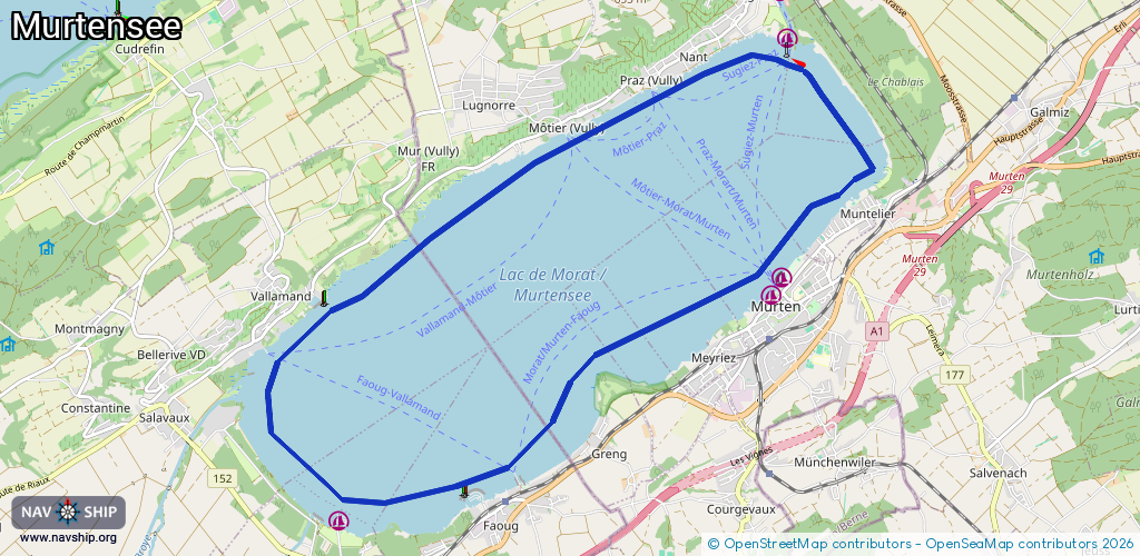
Route:
Please wait, loading route graphic...
Request waterway overview map with symbol legend here (Link).
Information about data associated with this body of water (6 available):
Data by OpenSeaMap (c) OSM contributors, www.openseamap.org
| # | Kind | Coordinates | Name | Information |
|---|---|---|---|---|
| 1 | Marina | 46.93003,7.11562 | 2021-07-29T17:20:14Z | Sportboothafen |
| 2 | Marina | 46.93176,7.11726 | 2023-01-03T14:34:49Z | |
| 3 | Marina | 46.90603,7.0487 | 2025-02-27T06:57:48Z | Port d'Avenches |
| 4 | Slipway | 46.93209,7.11801 | Unknown | 2023-01-03T14:34:49Z |
| 5 | Slipway | 46.90814,7.07121 | small_craft_facility | 2014-08-10T08:55:03Z |
| 6 | Fuel station | 46.92949,7.04633 | 2024-08-17T10:52:39Z |