Waterway information

Kind:
Inland
Driving areas:
🇺🇸 United States of America
Length:
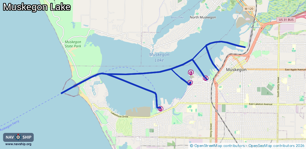
16.3 km¹
¹River kilometers or bank length recorded in NavShip, including river arms and harbor entrances.
Availability:
Completely recorded
Recent Update: 08.07.2025²
² This date indicates when an adjustment last took place in the course of the body of water
Recorded:
Locks: 0
Harbours / marinas: 3
Bridges: 0
Berths: 0
Slipways: 1
Fuelstations: 0
Route:
Please wait, loading route graphic...
Request waterway overview map with symbol legend here (Link).
Information about data associated with this body of water (4 available):
Data by OpenSeaMap (c) OSM contributors, www.openseamap.org
| # | Kind | Coordinates | Name | Information |
|---|---|---|---|---|
| 1 | Marina | 43.23027,-86.26586 | 2024-07-10T13:06:29Z | Hartshorn Marina |
| 2 | Marina | 43.23273,-86.27418 | 2025-11-07T19:21:21Z | Adelaide Pointe Marina +1 231-246-4500 https://adelaidepointe.com/marina/ |
| 3 | Marina | 43.22876,-86.27529 | 2025-08-10T18:04:14Z | Lakeshore Yacht Harbor +1 231 726 5770 https://lakeshoreyachtharbour.com/ |
| 4 | Slipway | 43.23219,-86.27401 | Unknown | 2025-10-13T19:01:02Z |