Waterway information

Kind:
Inland
Driving areas:
🇵🇱 Poland
Length:
6.3 km¹
¹River kilometers or bank length recorded in NavShip, including river arms and harbor entrances.
Availability:
Completely recorded
Recent Update: 12.12.2023²
² This date indicates when an adjustment last took place in the course of the body of water
Recorded:
Locks: 0
Harbours / marinas: 3
Bridges: 0
Berths: 0
Slipways: 0
Fuelstations: 0
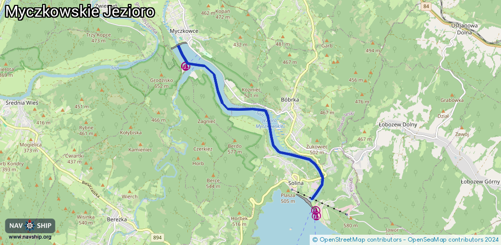
Route:
Please wait, loading route graphic...
Request waterway overview map with symbol legend here (Link).
Information about data associated with this body of water (3 available):
Data by OpenSeaMap (c) OSM contributors, www.openseamap.org
| # | Kind | Coordinates | Name | Information |
|---|---|---|---|---|
| 1 | Marina | 49.39337,22.45677 | 2019-09-29T03:27:26Z | Port Solina http://port-solina.pl/ |
| 2 | Marina | 49.42626,22.41125 | 2022-04-12T01:53:23Z | Przystań Elektromex |
| 3 | Marina | 49.42619,22.41117 | 2022-04-12T01:53:23Z | Przystań Elektromex |