Waterway information

Kind:
Inland
Driving areas:
🇳🇱 Netherlands
Length:
3.5 km¹
¹River kilometers or bank length recorded in NavShip, including river arms and harbor entrances.
Availability:
Completely recorded
Recent Update: 26.09.2022²
² This date indicates when an adjustment last took place in the course of the body of water
Recorded:
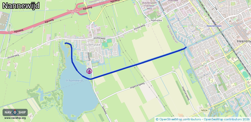
Locks: 1
Harbours / marinas: 1
Bridges: 2
Berths: 0
Slipways: 0
Fuelstations: 0
Route:
Please wait, loading route graphic...
Request waterway overview map with symbol legend here (Link).
Information about data associated with this body of water (3 available):
Data by OpenSeaMap (c) OSM contributors, www.openseamap.org
| # | Kind | Coordinates | Name | Information |
|---|---|---|---|---|
| 1 | Marina | 52.95044,5.87162 | 2022-06-02T06:57:01Z | WV Nannewijd |
| 2 | Bridge | 52.95485,5.90299 | 5.2 | Clearance height: 2018-07-29T17:54:38Z m Maximum passage width: 2.7 m fixed |
| 3 | Bridge | 52.94892,5.87293 | 4.7 | Clearance height: 2018-07-29T17:54:37Z m Maximum passage width: 2.6 m fixed |
| 3 | Bridge | 52.94892,5.87293 | 4.7 | Clearance height: 2018-07-29T17:54:37Z m Maximum passage width: 2.6 m fixed |