Waterway information

Kind:
Inland
Driving areas:
🌊 Baltic Sea
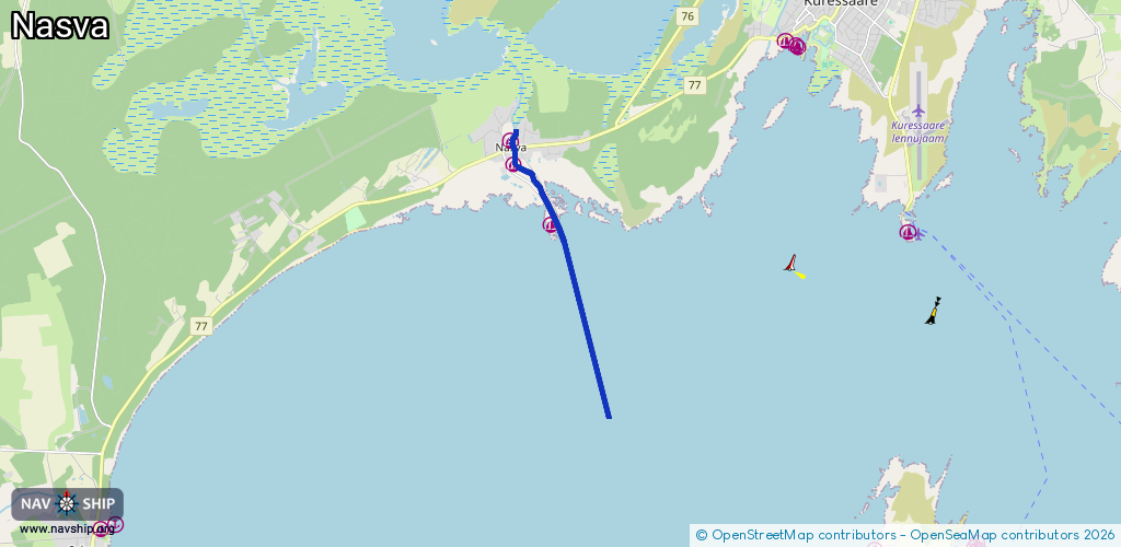
Length:
5.8 km¹
¹River kilometers or bank length recorded in NavShip, including river arms and harbor entrances.
Availability:
Completely recorded
Recent Update: 02.10.2025²
² This date indicates when an adjustment last took place in the course of the body of water
Recorded:
Locks: 1
Harbours / marinas: 3
Bridges: 0
Berths: 0
Slipways: 0
Fuelstations: 0
Route:
Please wait, loading route graphic...
Request waterway overview map with symbol legend here (Link).
Information about data associated with this body of water (3 available):
Data by OpenSeaMap (c) OSM contributors, www.openseamap.org
| # | Kind | Coordinates | Name | Information |
|---|---|---|---|---|
| 1 | Marina | 58.22945,22.38123 | 2023-05-08T09:07:30Z | Nasva jõesadam [email protected] +372 5023860 |
| 2 | Marina | 58.22567,22.38228 | 2023-01-30T14:27:20Z | Ahoi jõesadam +3725183187 |
| 3 | Marina | 58.21549,22.39386 | 2023-05-08T08:49:36Z | Nasva sadam [email protected] +372 5096667 https://bwb.ee/ |
| 3 | Marina | 58.21549,22.39386 | 2023-05-08T08:49:36Z | Nasva sadam [email protected] +372 5096667 https://bwb.ee/ |