Waterway information

Kind:
Inland
Driving areas:
🇮🇹 Italy🌊 Sea Mediterranean
Length:
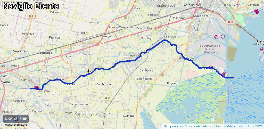
26.2 km¹
¹River kilometers or bank length recorded in NavShip, including river arms and harbor entrances.
Availability:
Completely recorded
Recent Update: 20.06.2023²
² This date indicates when an adjustment last took place in the course of the body of water
Recorded:
Locks: 3
Harbours / marinas: 3
Bridges: 0
Berths: 0
Slipways: 0
Fuelstations: 0
Route:
Please wait, loading route graphic...
Request waterway overview map with symbol legend here (Link).
Information about data associated with this body of water (5 available):
Data by OpenSeaMap (c) OSM contributors, www.openseamap.org
| # | Kind | Coordinates | Name | Information |
|---|---|---|---|---|
| 1 | Marina | 45.42155,12.25619 | 2025-08-13T15:15:10Z | |
| 2 | Marina | 45.42774,12.23821 | 2025-08-13T15:41:33Z | |
| 3 | Marina | 45.40847,12.00665 | 2020-09-24T20:29:51Z | |
| 4 | Lock | 45.4362,12.13955 | Unknown | |
| 5 | Lock | 45.42199,12.0773 | Unknown | |
| 5 | Lock | 45.42199,12.0773 | Unknown |