Waterway information

Kind:
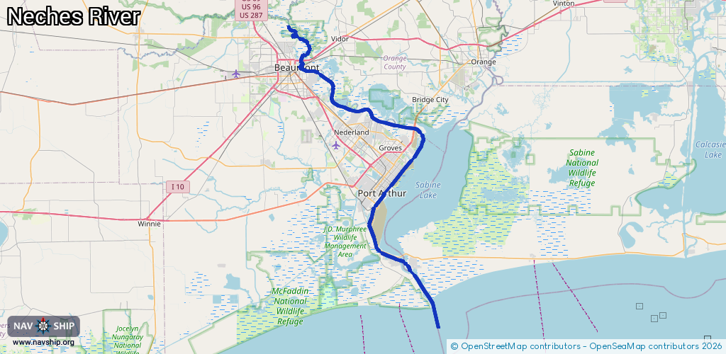
Inland
Driving areas:
🌊 Atlantic Ocean🇺🇸 United States of America
Length:
87.9 km¹
¹River kilometers or bank length recorded in NavShip, including river arms and harbor entrances.
Availability:
Completely recorded
Recent Update: 07.04.2025²
² This date indicates when an adjustment last took place in the course of the body of water
Recorded:
Locks: 0
Harbours / marinas: 1
Bridges: 0
Berths: 2
Slipways: 0
Fuelstations: 0
Route:
Please wait, loading route graphic...
Request waterway overview map with symbol legend here (Link).
Information about data associated with this body of water (3 available):
Data by OpenSeaMap (c) OSM contributors, www.openseamap.org
| # | Kind | Coordinates | Name | Information |
|---|---|---|---|---|
| 1 | Marina | 29.86762,-93.92627 | 2026-01-26T13:31:41Z | Pleasure Island Marina https://visitportarthurtx.com/things-to-do/attraction/pleasure-island-marina/ |
| 2 | Berth | 30.02716,-94.01005 | 2020-10-11T16:02:34Z | Beaumont Reserve Fleet The National Defense Reserve Fleet is designed provide a reserve of ships for national defense and national emergencies, mostly dry cargo ships with a few tankers and military auxiliaries. restricted |
| 3 | Berth | 30.01884,-93.9863 | 2020-10-11T14:19:05Z | Beaumont Reserve Fleet The National Defense Reserve Fleet is designed provide a reserve of ships for national defense and national emergencies, mostly dry cargo ships with a few tankers and military auxiliaries. restricted |