Waterway information

Kind:
Inland
Driving areas:
🇷🇺 Russia
Length:
11.3 km¹
¹River kilometers or bank length recorded in NavShip, including river arms and harbor entrances.
Availability:
Completely recorded
Recent Update: 17.12.2024²
² This date indicates when an adjustment last took place in the course of the body of water
Recorded:
Locks: 0
Harbours / marinas: 6
Bridges: 0
Berths: 0
Slipways: 0
Fuelstations: 0
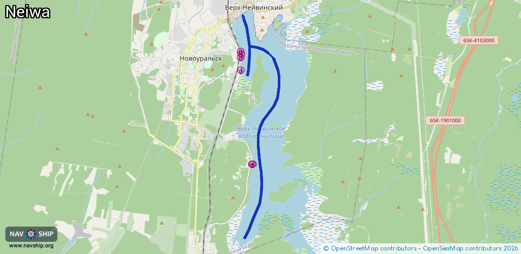
Route:
Please wait, loading route graphic...
Request waterway overview map with symbol legend here (Link).
Information about data associated with this body of water (6 available):
Data by OpenSeaMap (c) OSM contributors, www.openseamap.org
| # | Kind | Coordinates | Name | Information |
|---|---|---|---|---|
| 1 | Marina | 57.20823,60.1309 | 2022-03-02T12:03:54Z | |
| 2 | Marina | 57.20816,60.13038 | 2022-03-02T12:03:54Z | |
| 3 | Marina | 57.2429,60.12267 | 2021-06-24T04:16:19Z | |
| 4 | Marina | 57.24959,60.1226 | 2023-10-24T04:09:22Z | Яхт-клуб «Амур» |
| 5 | Marina | 57.2484,60.12278 | 2023-10-24T04:09:22Z | Яхт-клуб «Радуга» |
| 6 | Marina | 57.24762,60.1225 | 2023-10-24T04:09:22Z | Городской лодочный причал |