Waterway information

Kind:
Inland
Driving areas:
🇺🇸 United States of America
Length:
161.4 km¹
¹River kilometers or bank length recorded in NavShip, including river arms and harbor entrances.
Availability:
Completely recorded
Recent Update: 06.11.2025²
² This date indicates when an adjustment last took place in the course of the body of water
Recorded:
Locks: 0
Harbours / marinas: 0
Bridges: 0
Berths: 0
Slipways: 11
Fuelstations: 0
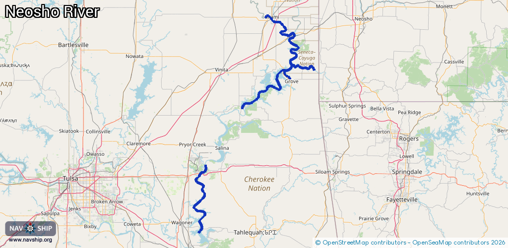
Route:
Please wait, loading route graphic...
Request waterway overview map with symbol legend here (Link).
Information about data associated with this body of water (11 available):
Data by OpenSeaMap (c) OSM contributors, www.openseamap.org
| # | Kind | Coordinates | Name | Information |
|---|---|---|---|---|
| 1 | Slipway | 36.63557,-94.81117 | small_craft_facility | 2013-05-13T03:22:59Z manually |
| 2 | Slipway | 36.63243,-94.81356 | small_craft_facility | 2013-05-13T03:22:59Z manually |
| 3 | Slipway | 36.62715,-94.80945 | small_craft_facility | 2013-05-13T03:22:59Z manually |
| 4 | Slipway | 36.62763,-94.80958 | small_craft_facility | 2013-05-13T03:22:59Z manually |
| 5 | Slipway | 36.62478,-94.8093 | small_craft_facility | 2013-05-13T03:22:58Z manually |
| 6 | Slipway | 36.62228,-94.80848 | small_craft_facility | 2013-05-13T03:22:58Z manually |
| 7 | Slipway | 36.62252,-94.80851 | small_craft_facility | 2013-05-13T03:22:58Z manually |
| 8 | Slipway | 36.62312,-94.80877 | small_craft_facility | 2013-05-13T03:22:58Z manually |
| 9 | Slipway | 36.62124,-94.80773 | small_craft_facility | 2013-05-13T03:22:58Z manually |
| 10 | Slipway | 36.6214,-94.80792 | small_craft_facility | 2013-05-13T03:22:58Z manually |
| 11 | Slipway | 36.61996,-94.80687 | small_craft_facility | 2013-05-13T03:22:58Z manually |