Waterway information

Kind:
Inland
Driving areas:
🇦🇺 Australia🌊 Pacific Ocean
Length:
25.5 km¹
¹River kilometers or bank length recorded in NavShip, including river arms and harbor entrances.
Availability:
Completely recorded
Recent Update: 12.09.2024²
² This date indicates when an adjustment last took place in the course of the body of water
Recorded:
Locks: 0
Harbours / marinas: 5
Bridges: 0
Berths: 0
Slipways: 0
Fuelstations: 0
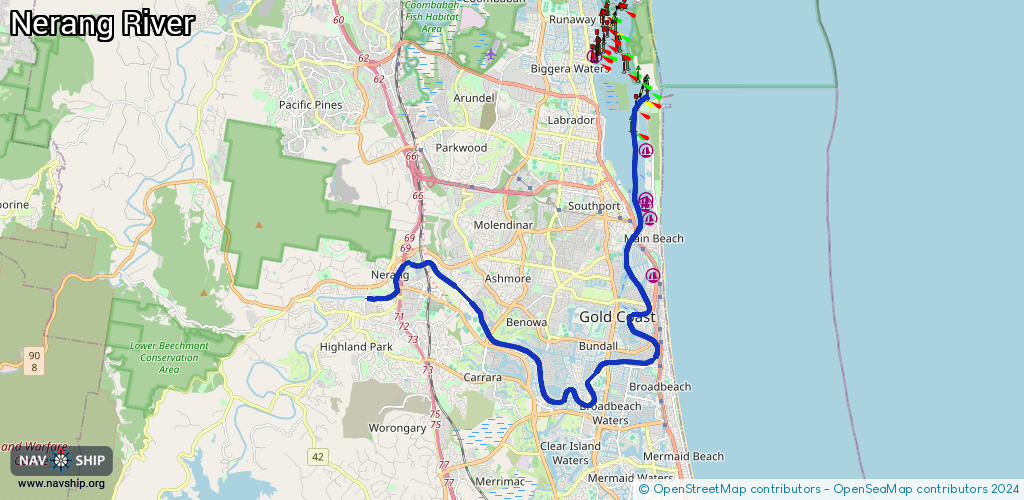
Route:
Please wait, loading route graphic...
Request waterway overview map with symbol legend here (Link).
Information about data associated with this body of water (5 available):
Data by OpenSeaMap (c) OSM contributors, www.openseamap.org
| # | Kind | Coordinates | Name | Information |
|---|---|---|---|---|
| 1 | Marina | -27.99017,153.42688 | 2021-09-03T06:24:42Z | |
| 2 | Marina | -27.97305,153.4264 | 2024-09-21T04:59:09Z | Southport Yacht Club Marina +61 7 5591 3500 https://www.southportyachtclub.com.au/waterfront/marina/ |
| 3 | Marina | -27.96859,153.42474 | 2022-11-12T10:17:02Z | Marina Mirage +61 7 5528 2328 http://www.marinamirage.com.au/marina/ |
| 4 | Marina | -27.96706,153.42462 | 2024-01-28T13:39:17Z | Imperial Hotel Gold Coast Marina +61 7 5509 8055 |
| 5 | Marina | -27.95217,153.42437 | 2025-08-29T11:30:41Z | Marine Rescue Southport Radio frequencies: 27 Mhz 86, 88, 91 VHF 16, 22, 67, 73, 82 MF/HF 2182, 2524, 4125 24/7 +61 7 5591 1300 |