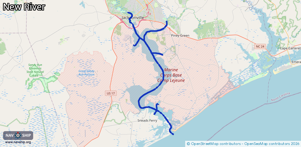
Waterway information

Kind:
Inland
Driving areas:
🌊 Atlantic Ocean🇺🇸 United States of America
Length:
52.2 km¹
¹River kilometers or bank length recorded in NavShip, including river arms and harbor entrances.
Availability:
Completely recorded
Recent Update: 08.04.2025²
² This date indicates when an adjustment last took place in the course of the body of water
Recorded:
Locks: 0
Harbours / marinas: 6
Bridges: 0
Berths: 0
Slipways: 1
Fuelstations: 0
Route:
Please wait, loading route graphic...
Request waterway overview map with symbol legend here (Link).
Information about data associated with this body of water (7 available):
Data by OpenSeaMap (c) OSM contributors, www.openseamap.org
| # | Kind | Coordinates | Name | Information |
|---|---|---|---|---|
| 1 | Marina | 34.56443,-77.38174 | 2022-08-18T16:32:55Z | Sneads Ferry Marina |
| 2 | Marina | 34.58284,-77.37207 | 2022-08-27T05:13:09Z | Courthouse Bay Marina |
| 3 | Marina | 34.57674,-77.39787 | 2022-08-18T14:08:36Z | |
| 4 | Marina | 34.57544,-77.39619 | 2022-09-10T22:06:40Z | |
| 5 | Marina | 34.69716,-77.43016 | 2022-08-26T08:51:36Z | |
| 6 | Marina | 34.67705,-77.36223 | 2022-08-27T05:30:42Z | Gottschalk Marina |
| 7 | Slipway | 34.6978,-77.43032 | Unknown | 2022-08-26T08:51:36Z |