Waterway information

Kind:
Inland
Driving areas:
🇩🇪 Germany
Length:
1.7 km¹
¹River kilometers or bank length recorded in NavShip, including river arms and harbor entrances.
Availability:
Completely recorded
Recent Update: 08.09.2025²
² This date indicates when an adjustment last took place in the course of the body of water
Recorded:
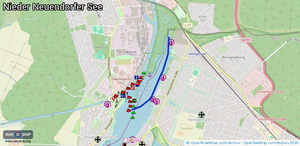
Locks: 0
Harbours / marinas: 4
Bridges: 0
Berths: 0
Slipways: 2
Fuelstations: 0
Route:
Please wait, loading route graphic...
Request waterway overview map with symbol legend here (Link).
Information about data associated with this body of water (6 available):
Data by OpenSeaMap (c) OSM contributors, www.openseamap.org
| # | Kind | Coordinates | Name | Information |
|---|---|---|---|---|
| 1 | Marina | 52.61588,13.216 | 2023-11-07T10:45:41Z | Fahrten-Segler Jörsfelde - FSJ [email protected] +49 30 43673123 https://www.fsj-berlin.de/ |
| 2 | Marina | 52.61556,13.21681 | 2024-09-16T19:12:19Z | |
| 3 | Marina | 52.61974,13.21916 | 2019-06-23T07:53:21Z | Heiligenseer Segel-Club +49 30 34507899 http://www.heiligenseer-segel-club.de/ |
| 4 | Marina | 52.62607,13.22132 | 2024-09-16T19:12:19Z | |
| 5 | Slipway | 52.61562,13.21649 | small_craft_facility | 2022-01-16T07:55:03Z |
| 6 | Slipway | 52.61577,13.21659 | small_craft_facility | 2022-01-16T07:55:03Z |