Waterway information

Kind:
Inland
Driving areas:
🇳🇱 Netherlands
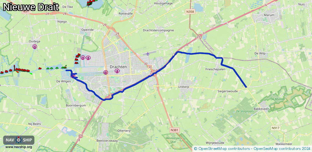
Length:
18.2 km¹
¹River kilometers or bank length recorded in NavShip, including river arms and harbor entrances.
Availability:
Completely recorded
Recent Update: 29.06.2023²
² This date indicates when an adjustment last took place in the course of the body of water
Recorded:
Locks: 0
Harbours / marinas: 2
Bridges: 4
Berths: 0
Slipways: 0
Fuelstations: 1
Route:
Please wait, loading route graphic...
Request waterway overview map with symbol legend here (Link).
Information about data associated with this body of water (7 available):
Data by OpenSeaMap (c) OSM contributors, www.openseamap.org
| # | Kind | Coordinates | Name | Information |
|---|---|---|---|---|
| 1 | Marina | 53.10284,6.04364 | 2022-05-31T19:39:23Z | De Drait |
| 2 | Marina | 53.10337,6.04346 | 2022-05-31T19:39:23Z | Bolt |
| 3 | Bridge | 53.10027,6.12249 | Unknown | Clearance height: 2022-06-07T20:26:40Z m |
| 4 | Bridge | 53.10641,6.13999 | Unknown | Clearance height: 2022-06-07T20:26:40Z m |
| 5 | Bridge | 53.10578,6.13818 | Unknown | Clearance height: 2022-06-07T20:26:40Z m |
| 6 | Bridge | 53.1052,6.13721 | Unknown | Clearance height: 2024-07-27T13:35:00Z m |
| 7 | Fuel station | 53.10205,6.04457 | 2024-09-23T15:59:05Z |