Waterway information

Kind:
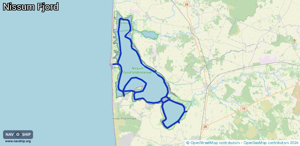
Lake
Driving areas:
🇩🇰 Denmark🌊 North Sea
Length:
57.5 km¹
¹River kilometers or bank length recorded in NavShip, including river arms and harbor entrances.
Availability:
Completely recorded
Recent Update: 09.01.2024²
² This date indicates when an adjustment last took place in the course of the body of water
Recorded:
Locks: 0
Harbours / marinas: 8
Bridges: 0
Berths: 0
Slipways: 1
Fuelstations: 0
Route:
Please wait, loading route graphic...
Request waterway overview map with symbol legend here (Link).
Information about data associated with this body of water (9 available):
Data by OpenSeaMap (c) OSM contributors, www.openseamap.org
| # | Kind | Coordinates | Name | Information |
|---|---|---|---|---|
| 1 | Marina | 56.32014,8.2366 | 2024-02-16T20:40:12Z | Felsted Kog Havn |
| 2 | Marina | 56.32182,8.20052 | 2024-01-13T09:11:10Z | Sandholm Havn |
| 3 | Marina | 56.3509,8.24418 | 2024-01-13T09:11:10Z | Damhus Å Havn |
| 4 | Marina | 56.37209,8.12426 | 2024-01-13T09:11:10Z | Thorsminde Slusehavn |
| 5 | Marina | 56.31086,8.29461 | 2024-10-06T07:24:51Z | Kytterup Havn |
| 6 | Marina | 56.29596,8.27755 | 2024-01-13T09:11:10Z | Kloster Havn |
| 7 | Marina | 56.33085,8.14749 | 2024-01-13T09:11:10Z | Helmklit Havn |
| 8 | Marina | 56.36361,8.22242 | 2024-02-16T20:40:12Z | Harpøt Havn |
| 9 | Slipway | 56.36342,8.22247 | Unknown | 2023-04-03T08:17:48Z |