Waterway information

Kind:
Inland
Driving areas:
🌊 Atlantic Ocean🇫🇷 France🇪🇸 Spain
Length:
9.8 km¹
¹River kilometers or bank length recorded in NavShip, including river arms and harbor entrances.
Availability:
Completely recorded
Recent Update: 15.04.2025²
² This date indicates when an adjustment last took place in the course of the body of water
Recorded:
Locks: 0
Harbours / marinas: 4
Bridges: 0
Berths: 3
Slipways: 0
Fuelstations: 0
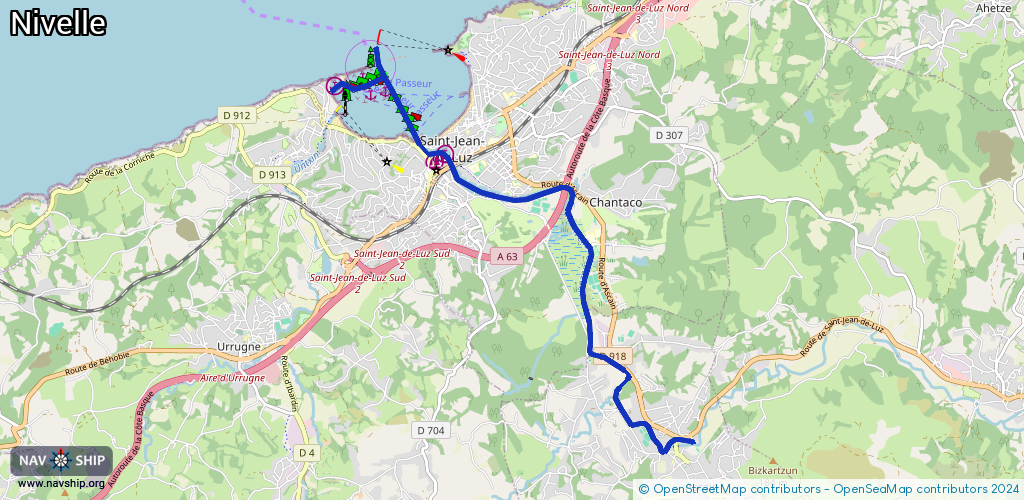
Route:
Please wait, loading route graphic...
Request waterway overview map with symbol legend here (Link).
Information about data associated with this body of water (7 available):
Data by OpenSeaMap (c) OSM contributors, www.openseamap.org
| # | Kind | Coordinates | Name | Information |
|---|---|---|---|---|
| 1 | Marina | 43.38238,-1.65788 | 2025-08-10T17:08:04Z | La Nivelle - Port |
| 2 | Marina | 43.38653,-1.66512 | 2025-08-10T17:08:04Z | Port de Pêche Saint-Jean de Luz Port de pêche ancestral et artisanal depuis le 15ème siècle. Pêche de l'anchois, du thon et du merlu. |
| 3 | Marina | 43.38551,-1.6668 | 2025-10-09T18:54:46Z | Ciboure - Larraldenia |
| 4 | Marina | 43.39494,-1.68384 | 2015-11-11T09:06:27Z | Socoa |
| 5 | Berth | 43.39443,-1.6755 | 2019-10-26T09:40:48Z | Mouillage des Carrelets |
| 6 | Berth | 43.39581,-1.67975 | 2022-05-27T04:46:02Z | Mouillage du Fort de Socoa |
| 7 | Berth | 43.39384,-1.67836 | 2019-10-24T13:43:22Z | Mouillage de l'Untxin |