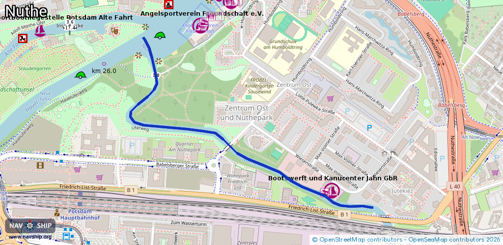
Waterway information

Kind:
Inland
Driving areas:
🇩🇪 Germany
Length:
1.1 km¹
¹River kilometers or bank length recorded in NavShip, including river arms and harbor entrances.
Availability:
Completely recorded
Recent Update: 10.08.2023²
² This date indicates when an adjustment last took place in the course of the body of water
Recorded:
Locks: 0
Harbours / marinas: 1
Bridges: 1
Berths: 0
Slipways: 1
Fuelstations: 0
Route:
Please wait, loading route graphic...
Request waterway overview map with symbol legend here (Link).
Information about data associated with this body of water (3 available):
Data by OpenSeaMap (c) OSM contributors, www.openseamap.org
| # | Kind | Coordinates | Name | Information |
|---|---|---|---|---|
| 1 | Marina | 52.39182,13.07821 | 2024-10-20T14:42:15Z | Bootswerft und Kanucenter Jahn GbR 2024-10-20 [email protected] +49 331 7480415 http://www.bootswerft-jahn.de/ |
| 2 | Bridge | 52.39496,13.07053 | Unknown | Clearance height: 2019-05-24T08:13:22Z m Maximum passage width: 1.8 m Movable bridge (e.g. lifting bridge or drawbridge) fixed |
| 3 | Slipway | 52.39182,13.07792 | small_craft_facility | 2019-11-14T13:17:07Z |