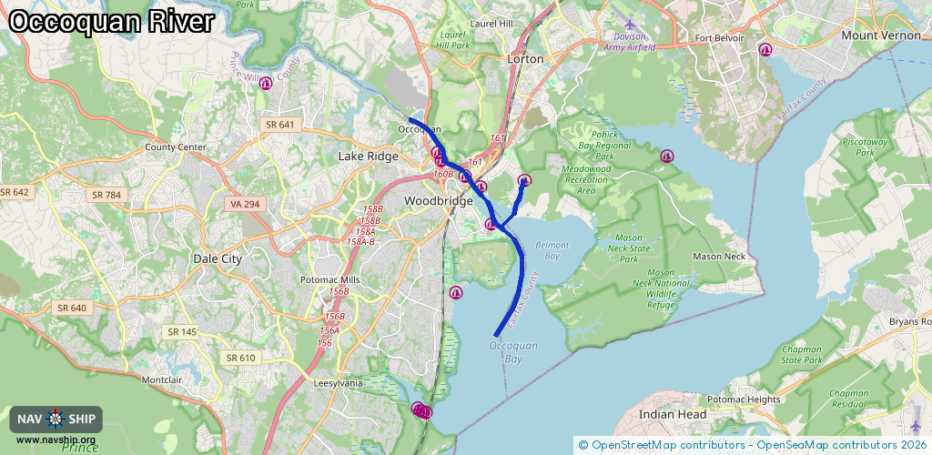
Waterway information

Kind:
Inland
Driving areas:
🇺🇸 United States of America
Length:
10.6 km¹
¹River kilometers or bank length recorded in NavShip, including river arms and harbor entrances.
Availability:
Completely recorded
Recent Update: 22.01.2024²
² This date indicates when an adjustment last took place in the course of the body of water
Recorded:
Locks: 0
Harbours / marinas: 6
Bridges: 0
Berths: 0
Slipways: 1
Fuelstations: 0
Route:
Please wait, loading route graphic...
Request waterway overview map with symbol legend here (Link).
Information about data associated with this body of water (7 available):
Data by OpenSeaMap (c) OSM contributors, www.openseamap.org
| # | Kind | Coordinates | Name | Information |
|---|---|---|---|---|
| 1 | Marina | 38.65571,-77.23381 | 2020-05-19T21:33:26Z | Belmont Bay Harbor Marina |
| 2 | Marina | 38.66662,-77.2375 | 2023-02-23T01:19:40Z | Captain John Beach Marina |
| 3 | Marina | 38.66956,-77.24354 | 2025-02-12T01:10:48Z | Occoquan Harbor Marina |
| 4 | Marina | 38.67425,-77.25189 | 2020-05-19T21:33:26Z | Hoffmasters Marina |
| 5 | Marina | 38.67706,-77.25355 | 2022-04-12T16:44:04Z | Prince William Marina |
| 6 | Marina | 38.6686,-77.22106 | 2020-05-19T21:33:26Z | Harbor View Marina |
| 7 | Slipway | 38.66964,-77.24388 | Unknown | 2024-10-23T14:11:49Z |