Waterway information

Kind:
Inland
Driving areas:
🇺🇸 United States of America
Length:
1.9 km¹
¹River kilometers or bank length recorded in NavShip, including river arms and harbor entrances.
Availability:
Completely recorded
Recent Update: 18.12.2023²
² This date indicates when an adjustment last took place in the course of the body of water
Recorded:
Locks: 0
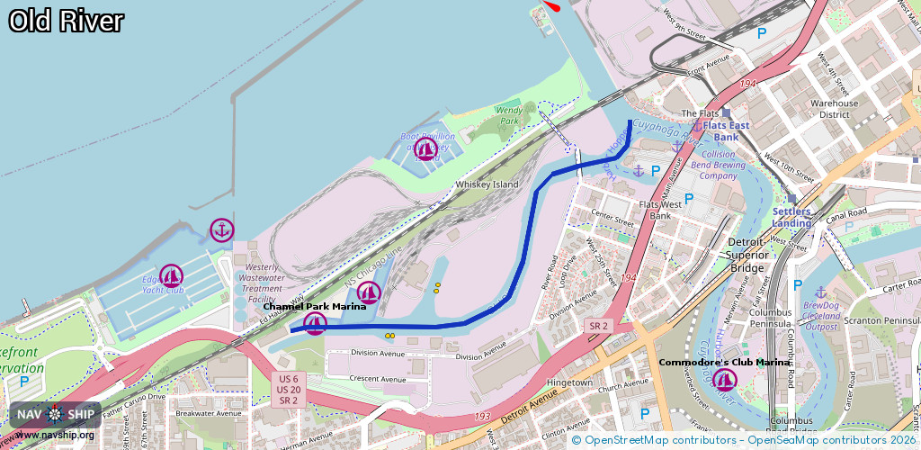
Harbours / marinas: 5
Bridges: 0
Berths: 0
Slipways: 0
Fuelstations: 0
Route:
Please wait, loading route graphic...
Request waterway overview map with symbol legend here (Link).
Information about data associated with this body of water (5 available):
Data by OpenSeaMap (c) OSM contributors, www.openseamap.org
| # | Kind | Coordinates | Name | Information |
|---|---|---|---|---|
| 1 | Marina | 41.49512,-81.72809 | 2024-09-29T20:47:07Z | |
| 2 | Marina | 41.49435,-81.72942 | 2025-05-26T16:31:32Z | Edgewater Yacht Club |
| 3 | Marina | 41.49189,-81.72346 | 2025-03-30T18:31:49Z | Channel Park Marina |
| 4 | Marina | 41.4931,-81.72066 | 2025-03-30T18:31:49Z | Olde River Yacht Club |
| 5 | Marina | 41.49804,-81.71814 | 2025-03-30T18:36:52Z | Boat Pavillion at Whiskey Island |