Waterway information

Kind:
Inland
Driving areas:
🌊 Atlantic Ocean🇺🇸 United States of America
Length:
5.1 km¹
¹River kilometers or bank length recorded in NavShip, including river arms and harbor entrances.
Availability:
Completely recorded
Recent Update: 19.01.2024²
² This date indicates when an adjustment last took place in the course of the body of water
Recorded:
Locks: 0
Harbours / marinas: 7
Bridges: 0
Berths: 0
Slipways: 0
Fuelstations: 0
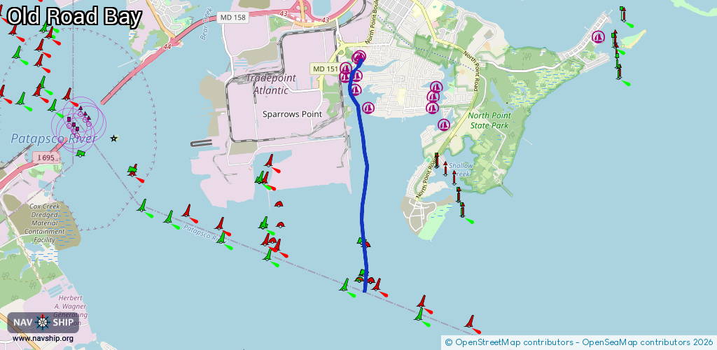
Route:
Please wait, loading route graphic...
Request waterway overview map with symbol legend here (Link).
Information about data associated with this body of water (7 available):
Data by OpenSeaMap (c) OSM contributors, www.openseamap.org
| # | Kind | Coordinates | Name | Information |
|---|---|---|---|---|
| 1 | Marina | 39.22009,-76.45727 | 2020-05-19T21:33:26Z | |
| 2 | Marina | 39.22396,-76.46038 | 2020-05-19T21:33:26Z | Atlantis Marina |
| 3 | Marina | 39.22652,-76.46321 | 2020-05-19T21:33:26Z | North Point Yacht Club |
| 4 | Marina | 39.22652,-76.4602 | 2020-05-19T21:33:26Z | Young's Boat Yard +1 410 477 8607 |
| 5 | Marina | 39.22796,-76.46317 | 2020-05-19T21:33:26Z | Pleasant Yacht Club |
| 6 | Marina | 39.23022,-76.4596 | 2020-05-19T21:33:26Z | |
| 7 | Marina | 39.2299,-76.45988 | 2020-05-19T21:33:26Z | Meehan's Marina |