Waterway information

Kind:
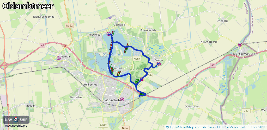
Inland
Driving areas:
🇳🇱 Netherlands
Length:
17.4 km¹
¹River kilometers or bank length recorded in NavShip, including river arms and harbor entrances.
Availability:
Completely recorded
Recent Update: 06.02.2025²
² This date indicates when an adjustment last took place in the course of the body of water
Recorded:
Locks: 0
Harbours / marinas: 5
Bridges: 0
Berths: 0
Slipways: 3
Fuelstations: 0
Route:
Please wait, loading route graphic...
Request waterway overview map with symbol legend here (Link).
Information about data associated with this body of water (8 available):
Data by OpenSeaMap (c) OSM contributors, www.openseamap.org
| # | Kind | Coordinates | Name | Information |
|---|---|---|---|---|
| 1 | Marina | 53.19565,7.03148 | 2023-05-19T17:59:19Z | Jachthaven Midwolda [email protected] +31 6 52307528 https://jachthavensblauwestad.nl/jachthavens/jachthaven-midwolda |
| 2 | Marina | 53.16834,7.036 | 2025-03-06T18:05:00Z | Jachthaven |
| 3 | Marina | 53.16675,7.03578 | 2024-11-23T18:03:17Z | Jachthaven Havenkwartier Blauwestad https://jachthavensblauwestad.nl/jachthavens/havenkwartier-blauwestad |
| 4 | Marina | 53.17183,7.09694 | 2013-03-15T12:29:19Z | Jachthaven Beerta http://www.havendagenbeerta.nl/ |
| 5 | Marina | 53.15944,7.07506 | 2023-05-31T07:05:42Z | Jachthaven Reiderhaven [email protected] +31 6 53739742 https://www.reiderhaven.nl |
| 6 | Slipway | 53.17234,7.09769 | small_craft_facility | 2021-08-31T20:30:02Z |
| 7 | Slipway | 53.15924,7.07518 | small_craft_facility | 2020-06-28T11:53:13Z inlaat reiderhaven |
| 8 | Slipway | 53.18189,7.07694 | small_craft_facility | 2020-06-28T11:53:13Z inlaat finsterwolde |