Waterway information

Kind:
Inland
Driving areas:
🇺🇸 United States of America
Length:
15.3 km¹
¹River kilometers or bank length recorded in NavShip, including river arms and harbor entrances.
Availability:
Completely recorded
Recent Update: 01.04.2025²
² This date indicates when an adjustment last took place in the course of the body of water
Recorded:
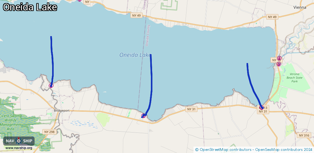
Locks: 0
Harbours / marinas: 3
Bridges: 0
Berths: 0
Slipways: 2
Fuelstations: 0
Route:
Please wait, loading route graphic...
Request waterway overview map with symbol legend here (Link).
Information about data associated with this body of water (5 available):
Data by OpenSeaMap (c) OSM contributors, www.openseamap.org
| # | Kind | Coordinates | Name | Information |
|---|---|---|---|---|
| 1 | Marina | 43.1511,-75.87768 | 2024-04-29T00:56:21Z | |
| 2 | Marina | 43.17621,-75.98117 | 2023-06-27T17:15:50Z | |
| 3 | Marina | 43.15772,-75.74557 | 2024-08-26T02:35:54Z | Marion Manor https://www.onemarinas.com/marion-manor |
| 4 | Slipway | 43.15113,-75.8754 | Unknown | 2014-02-16T19:45:10Z |
| 5 | Slipway | 43.15074,-75.87793 | Unknown | 2014-02-16T19:44:55Z |