Waterway information

Kind:
Sea
Driving areas:
🇳🇱 Netherlands
Length:
14.6 km¹
¹River kilometers or bank length recorded in NavShip, including river arms and harbor entrances.
Availability:
Completely recorded
Recent Update: 18.12.2023²
² This date indicates when an adjustment last took place in the course of the body of water
Recorded:
Locks: 1
Harbours / marinas: 5
Bridges: 2
Berths: 0
Slipways: 1
Fuelstations: 2
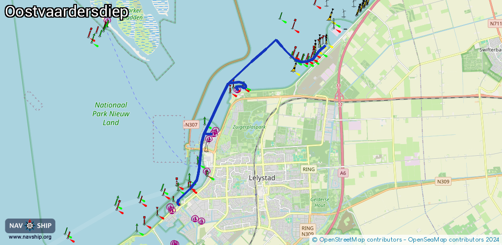
Route:
Please wait, loading route graphic...
Request waterway overview map with symbol legend here (Link).
Information about data associated with this body of water (10 available):
Data by OpenSeaMap (c) OSM contributors, www.openseamap.org
| # | Kind | Coordinates | Name | Information |
|---|---|---|---|---|
| 1 | Marina | 52.53204,5.4408 | 2024-04-29T17:24:47Z | Houtribhaven |
| 2 | Marina | 52.53358,5.44313 | 2023-08-08T22:29:13Z | Deko Marine |
| 3 | Marina | 52.53528,5.44427 | 2023-08-08T22:29:13Z | Parkhaven |
| 4 | Marina | 52.51789,5.43887 | 2024-07-03T18:12:02Z | Bataviahaven |
| 5 | Marina | 52.55238,5.46073 | 2023-08-08T22:29:13Z | Flevo Marina [email protected] +31 88 050 4170 https://www.flevomarina.com/ |
| 6 | Bridge | 52.52716,5.43467 | 18.04 | Clearance height: 2022-06-06T07:31:17Z m Maximum passage width: 7.40 m Movable bridge (e.g. lifting bridge or drawbridge) opening |
| 7 | Bridge | 52.52719,5.43403 | 18.04 | Clearance height: 2022-06-06T07:31:18Z m Maximum passage width: 7.40 m Movable bridge (e.g. lifting bridge or drawbridge) opening |
| 8 | Slipway | 52.51841,5.43711 | small_craft_facility | 2021-03-14T15:09:20Z |
| 9 | Fuel station | 52.51656,5.43756 | 2023-09-25T19:01:02Z | Zuiderzee +31 320 748 052 |
| 10 | Fuel station | 52.55184,5.45993 | 2024-04-29T17:24:47Z | Flevo Marina |
| 10 | Fuel station | 52.55184,5.45993 | 2024-04-29T17:24:47Z | Flevo Marina |