Waterway information

Kind:
Inland
Driving areas:
🇳🇱 Netherlands
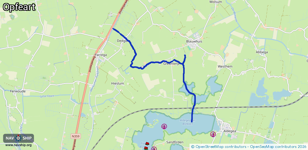
Length:
7 km¹
¹River kilometers or bank length recorded in NavShip, including river arms and harbor entrances.
Availability:
Completely recorded
Recent Update: 04.03.2025²
² This date indicates when an adjustment last took place in the course of the body of water
Recorded:
Locks: 0
Harbours / marinas: 0
Bridges: 11
Berths: 0
Slipways: 0
Fuelstations: 0
Route:
Please wait, loading route graphic...
Request waterway overview map with symbol legend here (Link).
Information about data associated with this body of water (11 available):
Data by OpenSeaMap (c) OSM contributors, www.openseamap.org
| # | Kind | Coordinates | Name | Information |
|---|---|---|---|---|
| 1 | Bridge | 53.02717,5.48663 | 2.6 | Clearance height: 2013-11-29T15:40:50Z m Maximum passage width: 0.9 m fixed |
| 2 | Bridge | 52.99998,5.53206 | Unknown | Clearance height: 2021-05-31T09:52:06Z m Maximum passage width: 2 m fixed |
| 3 | Bridge | 53.01597,5.5197 | Unknown | Clearance height: 2021-07-05T19:28:22Z m fixed |
| 4 | Bridge | 53.0156,5.51264 | Unknown | Clearance height: 2022-03-15T20:51:57Z m Maximum passage width: 0.7 m fixed |
| 5 | Bridge | 53.01401,5.50376 | Unknown | Clearance height: 2022-03-15T20:51:57Z m Maximum passage width: 0.55 m fixed |
| 6 | Bridge | 53.01393,5.5022 | Unknown | Clearance height: 2022-03-15T20:51:57Z m Maximum passage width: 1 m fixed |
| 7 | Bridge | 53.0147,5.49624 | Unknown | Clearance height: 2022-03-15T20:51:57Z m Maximum passage width: 1 m fixed |
| 8 | Bridge | 53.01998,5.49841 | Unknown | Clearance height: 2021-05-31T09:52:06Z m Maximum passage width: 0.1 m fixed |
| 9 | Bridge | 53.02222,5.4962 | Unknown | Clearance height: 2021-05-24T18:05:33Z m fixed |
| 10 | Bridge | 53.02411,5.49315 | Unknown | Clearance height: 2022-03-10T22:43:40Z m fixed |
| 11 | Bridge | 53.01769,5.52742 | Unknown | Clearance height: 2021-05-24T18:05:33Z m fixed |