Waterway information

Kind:
Inland
Driving areas:
🇫🇷 France🌊 Sea Mediterranean
Length:
12.5 km¹
¹River kilometers or bank length recorded in NavShip, including river arms and harbor entrances.
Availability:
Completely recorded
Recent Update: 08.08.2023²
² This date indicates when an adjustment last took place in the course of the body of water
Recorded:
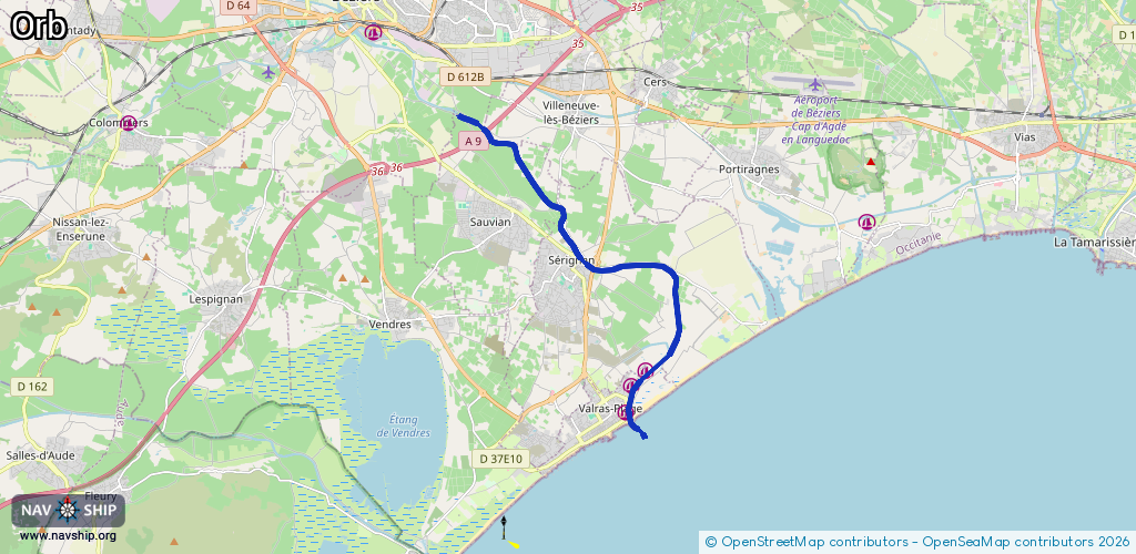
Locks: 0
Harbours / marinas: 2
Bridges: 0
Berths: 0
Slipways: 0
Fuelstations: 0
Route:
Please wait, loading route graphic...
Request waterway overview map with symbol legend here (Link).
Information about data associated with this body of water (2 available):
Data by OpenSeaMap (c) OSM contributors, www.openseamap.org
| # | Kind | Coordinates | Name | Information |
|---|---|---|---|---|
| 1 | Marina | 43.25792,3.30266 | 2025-01-03T00:39:25Z | Port de Sérignan [email protected] +33 4 67 809 989 http://beziers.cci.fr/1-12663-Port-de-Serignan.php |
| 2 | Marina | 43.24857,3.2965 | 2019-03-23T15:30:15Z | Port de Valras-Plage +33 4 67 32 60 06 https://www.ville-valrasplage.fr/index.php?option=com_content&view=section&id=5&Itemid=77 |