Waterway information

Kind:
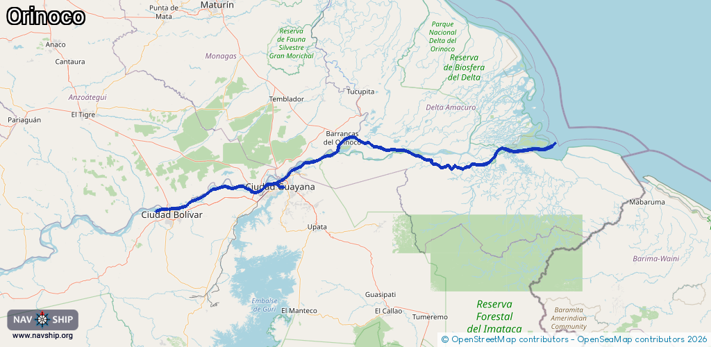
Inland
Driving areas:
🇻🇪 Venezuela
Length:
405.5 km¹
¹River kilometers or bank length recorded in NavShip, including river arms and harbor entrances.
Availability:
Completely recorded
Recent Update: 03.04.2025²
² This date indicates when an adjustment last took place in the course of the body of water
Recorded:
Locks: 0
Harbours / marinas: 2
Bridges: 1
Berths: 0
Slipways: 0
Fuelstations: 0
Route:
Please wait, loading route graphic...
Request waterway overview map with symbol legend here (Link).
Information about data associated with this body of water (3 available):
Data by OpenSeaMap (c) OSM contributors, www.openseamap.org
| # | Kind | Coordinates | Name | Information |
|---|---|---|---|---|
| 1 | Marina | 8.14837,-63.53389 | 2024-10-17T11:50:20Z | Club Nautico Orinoco |
| 2 | Marina | 8.34227,-62.71267 | 2021-12-18T20:30:17Z | https://photos.app.goo.gl/xMZnnzjaUC4R2e3R8 |
| 3 | Bridge | 8.31808,-62.66657 | Unknown | Clearance height: 2022-04-29T11:52:24Z m Movable bridge (e.g. lifting bridge or drawbridge) viaduct |