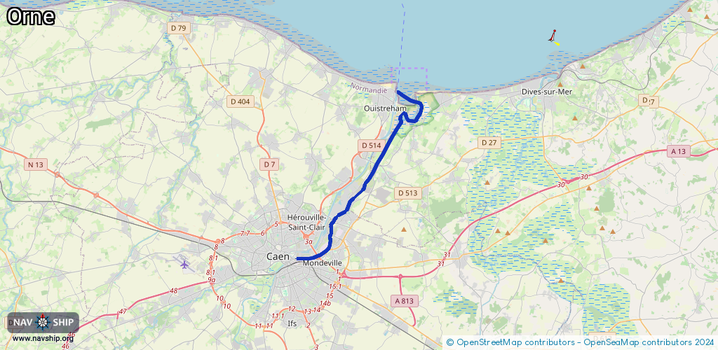
Waterway information

Kind:
Inland
Driving areas:
🌊 Atlantic Ocean🇫🇷 France
Length:
18.4 km¹
¹River kilometers or bank length recorded in NavShip, including river arms and harbor entrances.
Availability:
Completely recorded
Recent Update: 24.07.2023²
² This date indicates when an adjustment last took place in the course of the body of water
Recorded:
Locks: 0
Harbours / marinas: 2
Bridges: 0
Berths: 0
Slipways: 3
Fuelstations: 0
Route:
Please wait, loading route graphic...
Request waterway overview map with symbol legend here (Link).
Information about data associated with this body of water (5 available):
Data by OpenSeaMap (c) OSM contributors, www.openseamap.org
| # | Kind | Coordinates | Name | Information |
|---|---|---|---|---|
| 1 | Marina | 49.27487,-0.24798 | 2024-04-10T18:21:04Z | Port de Plaisance https://www.ouistreham-plaisance.com/ |
| 2 | Marina | 49.27971,-0.22402 | 2016-12-05T09:38:08Z | École de voile |
| 3 | Slipway | 49.27911,-0.2238 | small_craft_facility | 2016-12-05T09:38:08Z |
| 4 | Slipway | 49.27993,-0.22477 | small_craft_facility | 2016-12-05T09:38:08Z |
| 5 | Slipway | 49.28344,-0.24693 | small_craft_facility | 2021-02-07T12:50:37Z |