Waterway information

Kind:
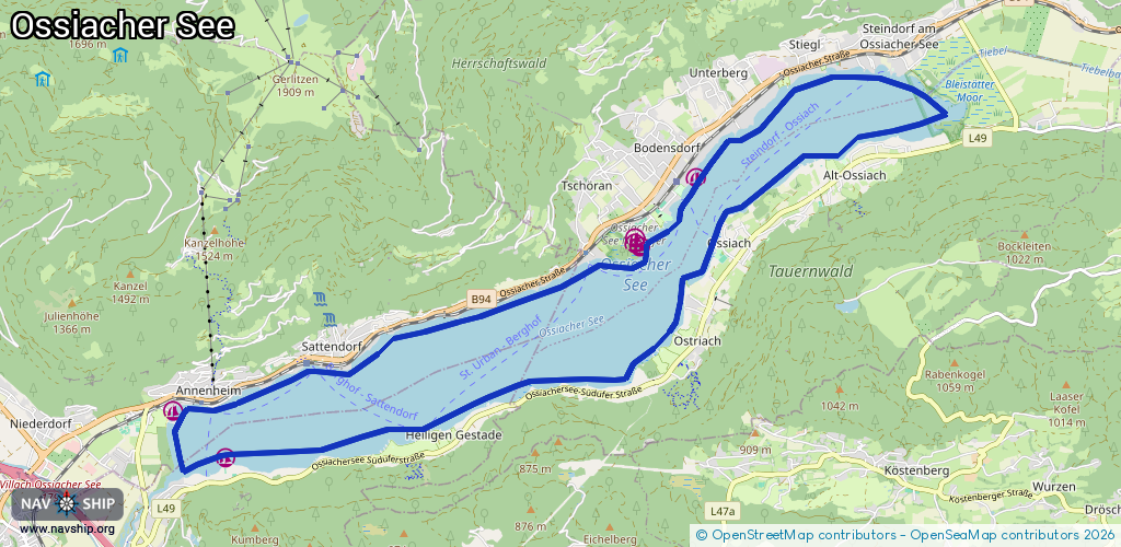
Lake
Driving areas:
🇦🇹 Austria
Length:
22.5 km¹
¹River kilometers or bank length recorded in NavShip, including river arms and harbor entrances.
Availability:
Completely recorded
Recent Update: 29.07.2024²
² This date indicates when an adjustment last took place in the course of the body of water
Recorded:
Locks: 0
Harbours / marinas: 6
Bridges: 0
Berths: 0
Slipways: 0
Fuelstations: 0
Route:
Please wait, loading route graphic...
Request waterway overview map with symbol legend here (Link).
Information about data associated with this body of water (6 available):
Data by OpenSeaMap (c) OSM contributors, www.openseamap.org
| # | Kind | Coordinates | Name | Information |
|---|---|---|---|---|
| 1 | Marina | 46.67577,13.96751 | 2024-08-09T11:22:26Z | |
| 2 | Marina | 46.67638,13.96755 | 2024-08-09T11:22:29Z | |
| 3 | Marina | 46.67539,13.9683 | 2024-08-09T11:22:25Z | |
| 4 | Marina | 46.68283,13.97711 | 2024-08-17T18:09:54Z | Kärnter Yachtklub Ossiachersee |
| 5 | Marina | 46.65264,13.90333 | 2022-08-19T17:00:41Z | Segelclub Ossiachersee (SCO) |
| 6 | Marina | 46.65765,13.89522 | 2022-08-19T17:00:41Z | Segelschule Rainer [email protected] +436503318000 https://www.surf-segelschule.at/ |