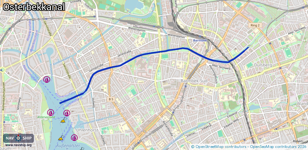
Waterway information

Kind:
Inland
Driving areas:
🇩🇪 Germany
Length:
4.1 km¹
¹River kilometers or bank length recorded in NavShip, including river arms and harbor entrances.
Availability:
Completely recorded
Recent Update: 06.07.2025²
² This date indicates when an adjustment last took place in the course of the body of water
Recorded:
Locks: 0
Harbours / marinas: 0
Bridges: 10
Berths: 0
Slipways: 0
Fuelstations: 0
Route:
Please wait, loading route graphic...
Request waterway overview map with symbol legend here (Link).
Information about data associated with this body of water (10 available):
Data by OpenSeaMap (c) OSM contributors, www.openseamap.org
| # | Kind | Coordinates | Name | Information |
|---|---|---|---|---|
| 1 | Bridge | 53.5835,10.05455 | Unknown | Clearance height: 2019-10-03T19:38:23Z m |
| 2 | Bridge | 53.58362,10.04702 | Unknown | Clearance height: 2019-10-03T19:38:23Z m |
| 3 | Bridge | 53.58389,10.04601 | Unknown | Clearance height: 2019-10-03T19:38:23Z m |
| 4 | Bridge | 53.58509,10.04219 | Unknown | Clearance height: 2019-10-03T19:38:23Z m |
| 5 | Bridge | 53.58524,10.03853 | Unknown | Clearance height: 2019-10-03T19:38:23Z m |
| 6 | Bridge | 53.58477,10.03369 | Unknown | Clearance height: 2019-10-03T19:38:23Z m |
| 7 | Bridge | 53.58429,10.02809 | Unknown | Clearance height: 2019-10-03T19:38:23Z m |
| 8 | Bridge | 53.58211,10.01957 | Unknown | Clearance height: 2019-10-03T19:38:23Z m |
| 9 | Bridge | 53.57936,10.01331 | Unknown | Clearance height: 2019-10-03T19:38:23Z m |
| 10 | Bridge | 53.5774,10.00999 | Unknown | Clearance height: 2019-10-03T19:38:23Z m |