Waterway information

Kind:
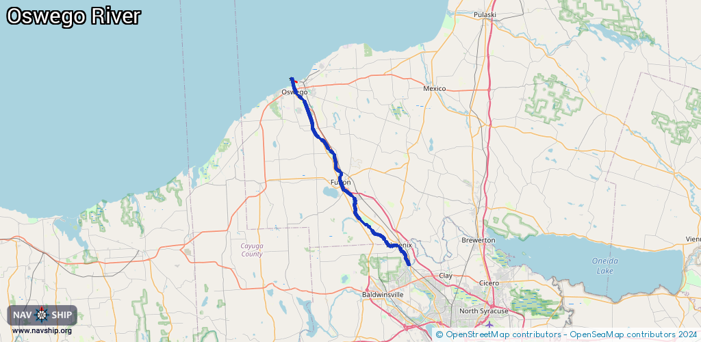
Inland
Driving areas:
🇺🇸 United States of America
Length:
39.3 km¹
¹River kilometers or bank length recorded in NavShip, including river arms and harbor entrances.
Availability:
Completely recorded
Recent Update: 28.11.2023²
² This date indicates when an adjustment last took place in the course of the body of water
Recorded:
Locks: 6
Harbours / marinas: 3
Bridges: 0
Berths: 0
Slipways: 0
Fuelstations: 0
Route:
Please wait, loading route graphic...
Request waterway overview map with symbol legend here (Link).
Information about data associated with this body of water (9 available):
Data by OpenSeaMap (c) OSM contributors, www.openseamap.org
| # | Kind | Coordinates | Name | Information |
|---|---|---|---|---|
| 1 | Marina | 43.46286,-76.51617 | 2022-03-12T16:50:14Z | Coast Guard Basin https://www.usgs.gov/centers/great-lakes-science-center/research-vessel-kaho |
| 2 | Marina | 43.46301,-76.52042 | 2020-09-07T21:49:43Z | Wrights Landing |
| 3 | Marina | 43.46365,-76.51781 | 2022-03-12T15:23:23Z | Wrights Landing |
| 4 | Lock | 43.22934,-76.30136 | Unknown | |
| 5 | Lock | 43.3165,-76.41468 | Unknown | |
| 6 | Lock | 43.32416,-76.4186 | Unknown | |
| 7 | Lock | 43.4004,-76.47315 | Unknown | |
| 8 | Lock | 43.44448,-76.49471 | Unknown | |
| 9 | Lock | 43.45093,-76.50465 | Unknown |